Mayerthorpe facts for kids
Quick facts for kids
Mayerthorpe
|
|
|---|---|
|
Town
|
|
| Town of Mayerthorpe | |

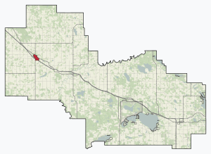
Location in Lac Ste. Anne County
|
|
| Country | Canada |
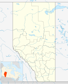
| Province | Alberta |
| Planning region | Upper Athabasca |
| Municipal district | Lac Ste. Anne County |
| Incorporated | |
| • Village | March 5, 1927 |
| • Town | March 20, 1961 |
| Area
(2021)
|
|
| • Land | 4.39 km2 (1.69 sq mi) |
| Elevation | 712 m (2,336 ft) |
| Population
(2021)
|
|
| • Total | 1,343 |
| Demonym(s) | Mayerthorpian |
| Time zone | UTC−7 (MST) |
| • Summer (DST) | UTC−6 (MDT) |
| Area code(s) | -1+780 |
| Highways | Highway 22 Highway 43 |
| Waterway | Paddle River |
Mayerthorpe is a small town located in central Alberta, Canada. It is about 120 kilometers (75 miles) northwest of Edmonton. You can find it where Highway 43 and Highway 22 (Cowboy Trail) meet. The town is surrounded by Lac Ste. Anne County.
Contents
Discovering Mayerthorpe's Past
How Mayerthorpe Got Its Name
The name Mayerthorpe comes from two parts. The first part, "Mayer," honors R. I. Mayer. He was the first postmaster when the post office opened in 1915. The second part, "thorpe," is an old English word. It means a small village or a hamlet. So, the name basically means "Mayer's Village."
Becoming a Village and a Town
Mayerthorpe officially became a village on March 5, 1927. Later, it grew bigger and became a town on March 20, 1961. This shows how the community has developed over the years.
Important Events in Mayerthorpe's History
- A Sad Day: On March 3, 2005, a very sad event happened in Mayerthorpe. Four RCMP officers lost their lives while serving their community. This event is remembered as the Mayerthorpe tragedy.
- The Arena Rebuilt: In 2008, the Mayerthorpe Arena was sadly destroyed by a fire. But the community worked together! After three years of planning and raising money, a brand new arena opened in 2011. It is now called the Mayerthorpe Exhibition Centre.
- Bridge Rebuilt Quickly: In 2016, a CN train bridge in the area was damaged by fire. But the railway company worked very fast. They rebuilt the bridge in about 20 days, showing how important it was for transportation.
Mayerthorpe's Community and People
Mayerthorpe is home to a friendly community. In 2021, about 1,343 people lived in the town. This number was a little bit higher than in 2016. The town covers an area of about 4.39 square kilometers (1.7 square miles).
Local News and Sports
Keeping Up with Local News
If you want to know what's happening in Mayerthorpe, you can read the local weekly newspaper. It's called the Mayerthorpe Freelancer.
Sports in Mayerthorpe
Mayerthorpe is also a place for sports! The Whitecourt Wild is a senior ice hockey team. They joined the North Central Hockey League in 2013. This team plays their games at the Mayerthorpe Exhibition Centre, the same place where the old arena used to be.


