Maynard, Arkansas facts for kids
Quick facts for kids
Maynard, Arkansas
|
|
|---|---|

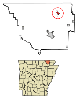
Location of Maynard in Randolph County, Arkansas.
|
|
| Country | United States |
| State | Arkansas |
| County | Randolph |
| Area | |
| • Total | 1.17 sq mi (3.03 km2) |
| • Land | 1.17 sq mi (3.03 km2) |
| • Water | 0.00 sq mi (0.00 km2) |
| Elevation | 433 ft (132 m) |
| Population
(2020)
|
|
| • Total | 379 |
| • Density | 323.65/sq mi (124.97/km2) |
| Time zone | UTC-6 (Central (CST)) |
| • Summer (DST) | UTC-5 (CDT) |
| ZIP code |
72444
|
| Area code(s) | 870 |
| FIPS code | 05-44780 |
| GNIS feature ID | 2406114 |
Maynard is a small town located in Randolph County, Arkansas, in the United States. In 2020, about 379 people lived there.
Maynard is known for its Maynard Pioneer Museum and Park. You can see an old jail there, built in 1936. Its door is made from wagon wheel rims! This jail was last used in 1988 and is next to the Maynard Community Center.
Contents
History of Maynard
Maynard was first settled in the late 1800s.
Early Schools
An important school called Abbott Institute opened in 1894. It was a boarding school, meaning students lived there. Later, it was known as Maynard Baptist Academy. This school was connected to a college now called Ouachita Baptist University.
A famous person named Drew Bowers, who became a federal attorney, went to this academy in the 1890s. He later studied at the University of Arkansas.
In 1928, the Maynard Baptist Academy was sold to the local school district. Its buildings were then used for the public school. Today, the only part of the old academy that remains is an arch. This arch was built by the last class of the academy in 1927. In 2008, the school's alumni (former students) helped restore the arch to remember the academy.
Modern Developments
In January 2011, a company called Verizon built a cell phone tower near Maynard. This helped improve cell service in the area.
Geography and Location
Maynard is located at 36°25′6″N 90°54′8″W / 36.41833°N 90.90222°W.
The town covers a total area of about 2.9 square kilometers (1.1 square miles). All of this area is land.
Highways in Maynard
Several highways pass through or near Maynard, connecting it to other towns. These include:
Population Information
| Historical population | |||
|---|---|---|---|
| Census | Pop. | %± | |
| 1900 | 358 | — | |
| 1910 | 295 | −17.6% | |
| 1920 | 210 | −28.8% | |
| 1930 | 259 | 23.3% | |
| 1940 | 266 | 2.7% | |
| 1950 | 216 | −18.8% | |
| 1960 | 201 | −6.9% | |
| 1970 | 224 | 11.4% | |
| 1980 | 381 | 70.1% | |
| 1990 | 354 | −7.1% | |
| 2000 | 381 | 7.6% | |
| 2010 | 426 | 11.8% | |
| 2020 | 379 | −11.0% | |
| U.S. Decennial Census | |||
In Maynard, there were 175 households. About 25.7% of these households had children under 18 living with them. Many households (49.7%) were married couples living together.
The average household had about 2.18 people. The average family had about 2.78 people.
The population of Maynard includes people of all ages. About 24.1% of the people were under 18 years old. About 22.3% were 65 years old or older. The average age in Maynard was 40 years.
Education in Maynard
Public schools in Maynard are part of the Maynard School District. This district provides education for students from elementary school through high school.
The schools in the district are:
- Maynard Elementary School
- Maynard High School
Notable People from Maynard
Some well-known individuals have connections to Maynard:
- Drew Bowers: He was a federal attorney who attended the Maynard Baptist Academy in the 1890s. He was originally from Pocahontas, Arkansas.
- Jonathan Dismang: He is an Arkansas state senator for District 28. He was born in Maynard.
See also
 In Spanish: Maynard (Arkansas) para niños
 | John T. Biggers |
 | Thomas Blackshear |
 | Mark Bradford |
 | Beverly Buchanan |

