McArthur Lake (Ontario) facts for kids
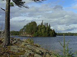
McArthur Lake is a beautiful lake in Ontario, Canada. It's located south of the city of Timmins. The lake has a rocky edge and 13 islands. People enjoy visiting in the summer for fun activities. In winter, the lake freezes solid! Most trees around the lake are evergreens, like pines, because of the cold weather. Interesting rocks near the lake might even contain nickel.
Contents
Where is McArthur Lake?
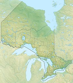
McArthur Lake is found in the Timiskaming District of Ontario. It's about 40 kilometers (25 miles) south of the city of Timmins. Most of the lake is in McArthur Township, but a small part stretches into Douglas Township.
The lake sits about 333 meters (1,093 feet) above sea level. It covers an area of about 1.5 square kilometers (0.6 square miles). The deepest part of the lake is about 35 feet (11 meters) deep.
Islands of McArthur Lake
McArthur Lake has 13 islands! Here are their names:
- McArthur Island
- Sharprock Island
- Blueberry Island
- Hidden Island
- Delta Island
- Shadfly Island
- Olyjian Isle
- Diorite Island
- Midway Island
- Crayfish Island
- Cat Island
- Maziic Island
- Taylor's Island
Weather Around the Lake
The area around McArthur Lake has a cool climate. It's called a Hemiboreal climate, which means it's a mix between a very cold northern climate and a milder one.
The average temperature for the whole year is about 1°C (34°F).
- The warmest month is July, with an average temperature of 16°C (61°F).
- The coldest month is January, with an average temperature of -18°C (0°F).
The lake area gets about 904 millimeters (35.6 inches) of rain and snow each year.
- The wettest month is August, with about 128 millimeters (5 inches) of rain.
- The driest month is February, with only about 11 millimeters (0.4 inches) of precipitation.
Nature and Activities
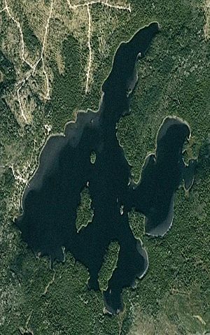
McArthur Lake has a rocky shoreline and three main bays. There are also 13 islands, as we learned! On the west side of the lake, you can find more than 20 camps and cottages.
People love to visit McArthur Lake for fun outdoor activities like:
- Kayaking
- Boating
- Fishing for walleye and northern pike
During the winter, the lake completely freezes over. In July, the water on the surface can get quite warm, reaching about 25°C (77°F).
Trees and Plants
The trees around McArthur Lake include:
- Cedars
- Poplars
- Balsam firs
- Different types of pines
You won't see many trees that lose their leaves in the fall (deciduous trees) because of the colder climate.
Water Quality
Scientists checked the amount of phosphorus in McArthur Lake between 2004 and 2007. Phosphorus is a nutrient that can sometimes cause too much algae to grow in lakes.
Here are the average levels they found:
| Date | West end, deep spot (µg/L) |
Mid-lake (µg/L) |
|---|---|---|
| 31 May 2004 | 6.69 | 6.52 |
| 16 May 2005 | 6.09 | 5.41 |
| 17 May 2007 | 7.28 | 6.63 |
All these levels are below 10 µg/L (micrograms per liter). This means McArthur Lake is considered "oligotrophic." An oligotrophic lake has very clear water and is unlikely to have problems with too many algae blooms, which is great for the lake's health!
Rocks and Minerals
McArthur Lake sits in an area with special kinds of rocks called ultramafic metavolcanic rocks. These rocks are part of something called the Tisdale Assemblage.
In the southwest part of the lake, there's a type of rock called diorite. The southern part of the lake also has two diabase dikes. These dikes are like long, thin walls of rock that cut through other rocks. They are part of the Sudbury dike swarm.
Some people have found small amounts of gold in the south of the lake. Also, most of McArthur Lake is part of the McArthur Lake Nickel Property. This property is owned by a company called Eloro Resources Ltd. They bought this land in 2007 because surveys showed that the rocks here might contain nickel, similar to other areas nearby.
See also
 In Spanish: Lago McArthur para niños
 | Charles R. Drew |
 | Benjamin Banneker |
 | Jane C. Wright |
 | Roger Arliner Young |


