McCormick, South Carolina facts for kids
Quick facts for kids
McCormick, South Carolina
|
||
|---|---|---|
|
Town
|
||
|
||

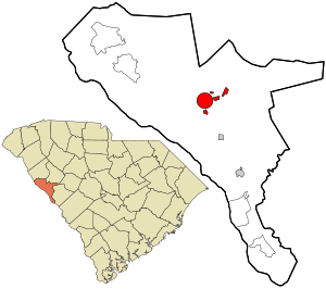
Location in McCormick County and the state of South Carolina.
|
||
| Country | United States | |
| State | South Carolina | |
| County | McCormick | |
| Area | ||
| • Total | 4.05 sq mi (10.49 km2) | |
| • Land | 4.05 sq mi (10.49 km2) | |
| • Water | 0.00 sq mi (0.00 km2) | |
| Elevation | 535 ft (163 m) | |
| Population
(2020)
|
||
| • Total | 2,232 | |
| • Density | 550.84/sq mi (212.70/km2) | |
| Time zone | UTC−5 (Eastern (EST)) | |
| • Summer (DST) | UTC−4 (EDT) | |
| ZIP codes |
29835, 29899
|
|
| Area codes | 864, 821 | |
| FIPS code | 45-43720 | |
| GNIS feature ID | 1246583 | |
| Website | www.townofmccormicksc.com | |
McCormick is a small town in McCormick County, South Carolina, United States. It is the main town, or "county seat," of McCormick County. The town was named after a famous inventor, Cyrus McCormick. In 2020, about 2,232 people lived here. As of July 2024, the population was estimated to be 2,225.
Contents
History of McCormick
The town of McCormick has many old and important buildings. These places are listed on the National Register of Historic Places. This means they are special and protected because of their history.
Historic Buildings and Sites
Some of these historic places include:
- The Dorn Gold Mine, where gold was once found.
- Dorn's Flour and Grist Mill, which helped process grains.
- The Joseph Jennings Dorn House, an old home.
- Eden Hall, another historic building.
- The Farmer's Bank, an important financial building from the past.
- The John Albert Gibert M.D. House, a doctor's old home.
- The Otway Henderson House.
- The Hotel Keturah, an old hotel.
- The McCormick County Courthouse, where local laws are made and justice is served.
- The McCormick Train Station, an old train stop.
- The M.L.B. Sturkey House.
Geography of McCormick
McCormick is located in South Carolina. It is found at specific coordinates: 33.913565 degrees North and -82.289154 degrees West.
Town Size
The town covers an area of about 3.8 square miles (which is about 10.49 square kilometers). All of this area is land, with no large bodies of water inside the town limits.
Population and People
The number of people living in McCormick has changed over the years. Here is a look at the population counts from different years:
| Historical population | |||
|---|---|---|---|
| Census | Pop. | %± | |
| 1900 | 237 | — | |
| 1910 | 613 | 158.6% | |
| 1920 | 1,284 | 109.5% | |
| 1930 | 1,304 | 1.6% | |
| 1940 | 1,456 | 11.7% | |
| 1950 | 1,744 | 19.8% | |
| 1960 | 1,998 | 14.6% | |
| 1970 | 1,864 | −6.7% | |
| 1980 | 1,725 | −7.5% | |
| 1990 | 1,659 | −3.8% | |
| 2000 | 1,489 | −10.2% | |
| 2010 | 2,783 | 86.9% | |
| 2020 | 2,232 | −19.8% | |
| U.S. Decennial Census | |||
Who Lives in McCormick?
In 2020, there were 2,232 people living in McCormick. These people made up 912 households. About 477 of these households were families. The town is home to people from different backgrounds.
| Race | Num. | Perc. |
|---|---|---|
| White (non-Hispanic) | 664 | 29.75% |
| Black or African American (non-Hispanic) | 1,467 | 65.73% |
| Native American | 4 | 0.18% |
| Asian | 10 | 0.45% |
| Other/Mixed | 52 | 2.33% |
| Hispanic or Latino | 35 | 1.57% |
Education in McCormick
McCormick offers several educational resources for its residents.
McCormick County Library
The town has a public library called the McCormick County Library. Libraries are great places to find books, learn new things, and use computers.
McCormick County School District
The McCormick County School District serves the local community. It provides public education for students. The district offers many different learning programs. It also has extracurricular activities to help students grow.
John de la Howe School
The John de la Howe School is also located in McCormick County. This is a special public high school. It is known as the Governor's School for Agriculture. It offers a unique and challenging program focused on agriculture. Students live at the school while they learn.
Notable People from McCormick
Several important people have connections to McCormick:
- John C. Calhoun - He was a Vice President of the United States.
- Johnny Letman - A talented Musician.
- Patrick Noble - He served as the Governor of South Carolina.
- Sara M. Evans - A respected Historian.
See also
 In Spanish: McCormick (Carolina del Sur) para niños
 | John T. Biggers |
 | Thomas Blackshear |
 | Mark Bradford |
 | Beverly Buchanan |

