
McKinley County, New Mexico facts for kids
Quick facts for kids
McKinley County
|
|
|---|---|

McKinley County Courthouse in Gallup
|
|

Location within the U.S. state of New Mexico
|
|
 New Mexico's location within the U.S. |
|
| Country | |
| State | |
| Founded | January 1, 1901 |
| Named for | William McKinley |
| Seat | Gallup |
| Largest city | Gallup |
| Area | |
| • Total | 5,455.5 sq mi (14,130 km2) |
| • Land | 5,450 sq mi (14,100 km2) |
| • Water | 5.5 sq mi (14 km2) 0.1%% |
| Population
(2020)
|
|
| • Total | 72,902 |
| • Density | 13/sq mi (5/km2) |
| Time zone | UTC−7 (Mountain) |
| • Summer (DST) | UTC−6 (MDT) |
| Congressional districts | 2nd, 3rd |
McKinley County is a county located in the northwest part of New Mexico, a state in the United States. In 2020, about 72,902 people lived there. The main city and government center of the county is Gallup. McKinley County was started in 1901. It was named after President William McKinley. The county is also part of the larger area around Gallup.
Contents
Geography of McKinley County
McKinley County covers a large area. Most of it is land. Only a very small part, about 0.1%, is covered by water.
Neighboring Areas
McKinley County shares its borders with several other counties:
- San Juan County to the north
- Sandoval County to the east
- Cibola County to the south
- Apache County, Arizona to the west
Main Roads
Several important highways run through McKinley County:
 Interstate 40
 U.S. Route 491 (This road used to be called US 666)
- New Mexico Highway 264
- New Mexico Highway 371
- New Mexico Highway 602
Protected Natural Areas
Parts of these special natural places are found in McKinley County:
- Chaco Culture National Historical Park (a park with ancient ruins)
- Cibola National Forest (a large forest area)
People and Population
The county's population has changed over the years. Here's how many people lived in McKinley County during different census years:
| Historical population | |||
|---|---|---|---|
| Census | Pop. | %± | |
| 1910 | 12,963 | — | |
| 1920 | 13,731 | 5.9% | |
| 1930 | 20,643 | 50.3% | |
| 1940 | 23,641 | 14.5% | |
| 1950 | 27,451 | 16.1% | |
| 1960 | 37,209 | 35.5% | |
| 1970 | 43,208 | 16.1% | |
| 1980 | 56,449 | 30.6% | |
| 1990 | 60,686 | 7.5% | |
| 2000 | 74,798 | 23.3% | |
| 2010 | 71,492 | −4.4% | |
| 2020 | 72,902 | 2.0% | |
| U.S. Decennial Census 1790–1960 1900–1990 1990–2000 2010 |
|||
Population in 2010
In 2010, about 71,492 people lived in McKinley County. Most of the people living here were Native American. There were also people of White, Asian, and Black or African American backgrounds. About 13.3% of the population was of Hispanic or Latino origin.
Many households in the county had children under 18 living with them. The average age of people in McKinley County was about 30.7 years old.
Communities in McKinley County
City
- Gallup (This is the county seat, meaning it's where the county government is located.)
Other Communities
These are smaller places in the county that are not officially cities:
- Buffalo Springs
- Chi Chil Tah
- Rehoboth
- Smith Lake
- Whitehorse
Education in McKinley County
Most public schools in McKinley County are managed by Gallup-McKinley County Schools. This school district includes several high schools like Crownpoint High School, Gallup High School, and Thoreau High School.
Some areas, especially near the Zuni reservation, are part of the Zuni Public School District. This district runs Zuni High School.
There are also special Bureau of Indian Education (BIE) schools. These include Wingate High School and Pueblo Pintado Community School. Another school, Ch'ooshgai Community School, is connected to the BIE and is located in Tohatchi.
Images for kids
-

Interstate 40 highway sign
-
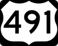
U.S. Route 491 highway sign
-
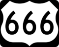
Old U.S. Route 666 highway sign


See also
 In Spanish: Condado de McKinley para niños
