
Meades Ranch Triangulation Station facts for kids
Quick facts for kids |
|
|
Geodetic Center of the U.S.
|
|

Meades Ranch triangulation station, ca. 1940
|
|

Location in Kansas
|
|
| Nearest city | Osborne, Kansas |
|---|---|
| Built | 1891 |
| NRHP reference No. | 73000772 |
| Added to NRHP | October 9, 1973 |
The Meades Ranch Triangulation Station is a special survey marker in Osborne County, Kansas. It was first placed in 1891. For many years, starting in 1901, this marker was the main reference point for all land measurements in the United States. This system of measurement is called a geodetic datum.
In 1913, Canada and Mexico also started using this same reference point. The system was later updated and named the North American Datum of 1927 (NAD27). A similar system for measuring height was created in 1929.
Later, a newer and more accurate system called the North American Datum of 1983 (NAD83) was developed. This new system uses a point deep inside the Earth's core as its reference. Because of this, the Meades Ranch marker is no longer the main reference point for maps.
Even though it's not the main reference anymore, the Meades Ranch site is still important. In 1973, it was added to the National Register of Historic Places as the Geodetic Center of the United States.
Contents
What is a Geodetic Datum?
When surveyors measure land, they need a starting point or a set of points. This starting point is called a geodetic datum. Imagine trying to draw a map of your town without knowing where "north" is or where the center of town is. A datum gives you those important starting directions and locations.
By knowing the exact location of one point and the direction from that point to another, surveyors can then figure out where all other places are. When mapping very large areas, like a whole country, the Earth's curved shape becomes important. Surveyors use a special curved model, like a slightly flattened ball, to represent the Earth's surface.
The first system for mapping the entire United States was set up in 1879. It used a point in Maryland as its main reference.
The Meades Ranch Station's Importance
The United States Coast and Geodetic Survey set up the Meades Ranch Triangulation Station in 1891. This spot was chosen because it was near where two major survey lines crossed. One line went from the Atlantic Ocean to the Pacific Ocean, and the other went from Mexico to Canada.
In 1901, the Meades Ranch station became the official standard reference point for all land measurements in the United States. It was picked because it was close to the geographic center of the U.S. and at the crossing of those two important survey lines. Its exact location was carefully recorded.
In 1913, both Canada and Mexico decided to use the Meades Ranch location as their main reference point too. Because of this, the system was renamed the "North American Datum."

Over time, as more and more surveys were added, it became hard to keep everything perfectly accurate. So, from 1927 to 1932, about 25,000 existing survey points were recalculated. This led to a new system called NAD27. The NAD27 system still used the Meades Ranch coordinates from 1901 as its main reference.
In 1973, the Meades Ranch site was recognized for its historical importance and added to the National Register of Historic Places.
The Shift to NAD83
After NAD27 was created, scientists noticed small errors in measurements, especially in northern areas. These errors happened because the old models of the Earth's shape weren't perfect. Also, the Earth's tectonic plates are always slowly moving, which can change land positions over many years.

To fix these problems, a new and much more accurate system was developed. It was called NAD83. This new system uses a more precise model of the Earth and is based on measurements from 250,000 points, including those from satellites.
NAD83 was officially adopted by the U.S. government in 1989 and by Canada in 1990. With this new system, the Meades Ranch station became just one of thousands of survey points. It no longer held its special role as the single main reference point.
Visiting the Site
As of 2012, the Meades Ranch station is located at 39°13′26.71220″N 98°32′31.74540″W / 39.2240867222°N 98.5421515000°W. It's about 12 miles (19 km) north of Lucas and 10 miles (16 km) southwest of Tipton.
The actual station is on a low, grassy hill in a private pasture. It's marked by a bronze disc that says "Meades Ranch 1891." This disc is set into the top of a concrete marker that sticks out about 4 inches (10 cm) from the ground.
The Meades Ranch station is on private land, so you can't visit the exact spot. However, there is a replica of the marker and a historical sign explaining its importance. You can find this replica at a roadside rest area near Osborne, Kansas, about 18 miles (29 km) northwest of the original site. The replica is located at 39°27′08″N 98°41′37″W / 39.452286°N 98.693542°W.
Images for kids
-
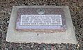
Marker at Osborne rest area, incorporating replica of Meades Ranch station marker disc

