Medicine River (Alberta) facts for kids
Quick facts for kids Medicine River |
|
|---|---|

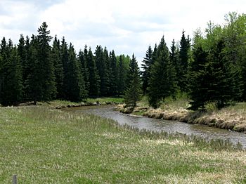
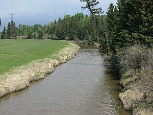
The Medicine River from Alberta Highway 53
|
|
| Country | Canada |
| Province | Alberta |
| Physical characteristics | |
| Main source | Medicine Lake 982 m (3,222 ft) 52°43′54″N 114°43′53″W / 52.73167°N 114.73139°W |
| River mouth | Red Deer River 894 m (2,933 ft) 52°03′36″N 114°05′56″W / 52.06000°N 114.09889°W |
The Medicine River is a medium-sized river in central Alberta, Canada. It starts from Medicine Lake, which is north of Rocky Mountain House. The river flows through a special protected area called the Rocky Mountain House Grazing Reserve. This area is huge, covering over 15,000 acres (61 km2) of land. It is used for cattle to graze and for people to enjoy outdoor activities.
As the Medicine River flows southwest, it collects water from many smaller creeks. It then passes by the town of Eckville. Finally, the Medicine River joins the Red Deer River north of Innisfail. This meeting point is called the Medicine Flats. Several major roads in Alberta cross over the Medicine River, including Highway 53, Highway 12, Highway 11, and Highway 54.
What's in a Name?
The name "Medicine River" comes from the Cree language. It is a translation of the Cree words muskiki and nipagwasimow. These words together mean "Sundance river." The name "Medicine River" first appeared on a map made by John Arrowsmith in 1859.
Where Does the Water Come From?
The Medicine River gets its water from many smaller streams and creeks that flow into it. These smaller waterways are called tributaries. They help feed the main river, making it bigger and stronger as it flows.
Main Tributaries
Here are some of the important creeks that join the Medicine River:
- Open Creek
- Wilson Creek
- Welch Creek
- Block Creek
- Wood Lake
- Blueberry Creek
- Lobstick Creek
- Lasthill Creek
- Tindastoll Creek
- Dickson Creek
Images for kids
 | Delilah Pierce |
 | Gordon Parks |
 | Augusta Savage |
 | Charles Ethan Porter |


