
Menard, Texas facts for kids
Quick facts for kids
Menard, Texas
|
|
|---|---|

Menard welcome sign
|
|

Location of Menard, Texas
|
|
 |
|
| Country | United States |
| State | Texas |
| County | Menard |
| Area | |
| • Total | 2.06 sq mi (5.34 km2) |
| • Land | 2.06 sq mi (5.34 km2) |
| • Water | 0.00 sq mi (0.00 km2) |
| Elevation | 1,877 ft (572 m) |
| Population
(2020)
|
|
| • Total | 1,348 |
| • Density | 654.37/sq mi (252.43/km2) |
| Time zone | UTC-6 (Central (CST)) |
| • Summer (DST) | UTC-5 (CDT) |
| ZIP code |
76859
|
| Area code(s) | 325 |
| FIPS code | 48-47628 |
| GNIS feature ID | 2411076 |
Menard is a city in Texas, United States. It is the main town and county seat of Menard County. In 2020, about 1,348 people lived there.
Contents
Where is Menard Located?
Menard is found next to the San Saba River. It is where two major roads, U.S. Highways 83 and 190, meet. The city is in central Menard County. It is about 140 miles northwest of Austin and San Antonio.
The city covers about 2.1 square miles (5.34 square kilometers) of land. There is no water area within the city limits.
A Look at Menard's Past
Early Settlements and Forts
The first settlement in Menard was a Spanish mission and a fort. These were called Mission San Sabá and Presidio de San Luís de Amarillas. They were built in April 1757. The fort was later replaced by the Presidio of San Sabá in 1761. These were meant to protect the northern border of New Spain. They helped guard against attacks from Native American groups.
The fort was far away from other towns. It was attacked many times. Because of this, it was left empty in 1770. Later settlers used stones from the old fort walls to build their homes. The ruins of the old fort were rebuilt in 1936.
Growth of Menardville
The community was first called Menardville. It was started in 1858 when Menard County was formed. A nearby fort, Fort McKavett, was closed in 1859. This left the settlers with little protection from Native American raids. The fort reopened after the Civil War.
By 1867, Menardville had a store, a blacksmith shop, and a saloon. It was a busy trading spot. It was also a stop for cowboys moving cattle north and west. The county government started in 1871. A two-story courthouse was built a year later. Around 150 people lived in Menardville by the mid-1880s. In 1899, the San Saba River flooded. This caused a lot of damage to the town.
The Railroad and Modern Times
Around 1910 or 1911, a railroad company planned to build tracks through the town. They asked the people to change the town's name to Menard. This would make it easier to paint signs. When the first train arrived in 1911, the town grew quickly.
In 1920, 1,164 people lived in Menard. For many years, it was the main place for shipping goods in Menard County. The town was affected by the Great Depression. But both of its banks stayed open. Menard's population grew to 1,969 in 1930. It reached 2,375 in 1940 and 2,685 in 1950.
The population started to get smaller in the 1950s and 1960s. This was because roads got better. People could travel and ship goods without relying on trains as much. The Atchison, Topeka and Santa Fe Railroad stopped its service to Menard in 1972. They gave the train station to the county. It became a history museum. The Menard County Historical Society started collecting old items in 1975. The museum opened in 1978. By 1980, 1,697 people lived in Menard. The population was 1,606 in 1990 and 1,653 in 2000.
Menard's Population Over Time
| Historical population | |||
|---|---|---|---|
| Census | Pop. | %± | |
| 1880 | 67 | — | |
| 1890 | 185 | 176.1% | |
| 1920 | 1,164 | — | |
| 1930 | 1,969 | 69.2% | |
| 1940 | 2,375 | 20.6% | |
| 1950 | 2,685 | 13.1% | |
| 1960 | 1,914 | −28.7% | |
| 1970 | 1,740 | −9.1% | |
| 1980 | 1,697 | −2.5% | |
| 1990 | 1,606 | −5.4% | |
| 2000 | 1,653 | 2.9% | |
| 2010 | 1,471 | −11.0% | |
| 2020 | 1,348 | −8.4% | |
| U.S. Decennial Census | |||
Who Lives in Menard? (2020 Census)
| Race | Number | Percentage |
|---|---|---|
| White (NH) | 690 | 51.19% |
| Black or African American (NH) | 10 | 0.74% |
| Native American or Alaska Native (NH) | 6 | 0.45% |
| Asian (NH) | 4 | 0.3% |
| Pacific Islander (NH) | 2 | 0.15% |
| Some Other Race (NH) | 4 | 0.3% |
| Mixed/Multi-Racial (NH) | 27 | 2.0% |
| Hispanic or Latino | 605 | 44.88% |
| Total | 1,348 |
In 2020, there were 1,348 people living in Menard. These people lived in 735 households. There were 356 families in the city.

Learning in Menard
Public schools in Menard are part of the Menard Independent School District. Students attend Menard High School. The school's sports teams are called the Yellow Jackets.
Fun Things to Do in Menard
Menard has several yearly events.
- The Jim Bowie Trail Ride happens in September.
- The Saucedo family reunion is another event.
- The Silver Mine Classic Lamb Show takes place in October.
Menard's Climate
The weather in Menard has hot, humid summers. Winters are usually mild to cool. Menard has a humid subtropical climate. This means it gets a lot of rain and has warm temperatures for most of the year.
| Climate data for Menard, Texas (1991–2020 normals, extremes 1895–1905, 1914–1933, 1962–2019) | |||||||||||||
|---|---|---|---|---|---|---|---|---|---|---|---|---|---|
| Month | Jan | Feb | Mar | Apr | May | Jun | Jul | Aug | Sep | Oct | Nov | Dec | Year |
| Record high °F (°C) | 91 (33) |
97 (36) |
98 (37) |
107 (42) |
114 (46) |
112 (44) |
111 (44) |
110 (43) |
109 (43) |
99 (37) |
93 (34) |
87 (31) |
114 (46) |
| Mean daily maximum °F (°C) | 59.9 (15.5) |
64.5 (18.1) |
71.4 (21.9) |
79.9 (26.6) |
85.9 (29.9) |
91.5 (33.1) |
95.1 (35.1) |
94.8 (34.9) |
88.1 (31.2) |
79.8 (26.6) |
68.2 (20.1) |
60.9 (16.1) |
78.3 (25.7) |
| Daily mean °F (°C) | 44.7 (7.1) |
48.8 (9.3) |
56.0 (13.3) |
64.1 (17.8) |
72.0 (22.2) |
78.4 (25.8) |
81.4 (27.4) |
80.9 (27.2) |
74.1 (23.4) |
64.5 (18.1) |
53.6 (12.0) |
46.0 (7.8) |
63.7 (17.6) |
| Mean daily minimum °F (°C) | 29.4 (−1.4) |
33.2 (0.7) |
40.6 (4.8) |
48.3 (9.1) |
58.1 (14.5) |
65.3 (18.5) |
67.8 (19.9) |
67.0 (19.4) |
60.1 (15.6) |
49.1 (9.5) |
39.0 (3.9) |
31.0 (−0.6) |
49.1 (9.5) |
| Record low °F (°C) | −2 (−19) |
−1 (−18) |
7 (−14) |
20 (−7) |
27 (−3) |
43 (6) |
48 (9) |
40 (4) |
33 (1) |
20 (−7) |
9 (−13) |
−6 (−21) |
−6 (−21) |
| Average precipitation inches (mm) | 1.11 (28) |
1.35 (34) |
2.10 (53) |
2.00 (51) |
3.40 (86) |
3.07 (78) |
1.58 (40) |
2.00 (51) |
2.20 (56) |
2.50 (64) |
1.80 (46) |
1.21 (31) |
24.32 (618) |
| Average precipitation days (≥ 0.01 in) | 5.2 | 5.1 | 5.8 | 4.7 | 5.8 | 6.0 | 4.4 | 5.8 | 5.1 | 5.3 | 4.7 | 4.4 | 62.3 |
| Source: NOAA | |||||||||||||
Gallery
-
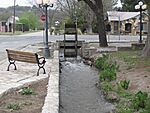
"The Ditch"
-
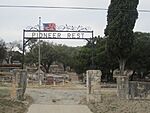
Pioneer Rest Cemetery in Menard has graves from the 19th century
-
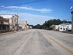
Downtown Menard on a nearly deserted summer Saturday evening
-
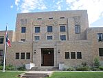
Menard County Courthouse in Menard, Texas
-
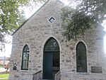
Sacred Heart Catholic Church (1899 building) in Menard
-
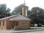
First United Methodist Church in Menard


See also
 In Spanish: Menard (Texas) para niños
