Mennock facts for kids
Quick facts for kids Mennock
|
|
|---|---|
| OS grid reference | NS 80785 08068 |
| Council area | |
| Lieutenancy area | |
| Country | Scotland |
| Sovereign state | United Kingdom |
| Post town | SANQUHAR |
| Postcode district | DG4 |
| Dialling code | 01659 |
| Police | Dumfries and Galloway |
| Fire | Dumfries and Galloway |
| Ambulance | Scottish |
| EU Parliament | Scotland |
| UK Parliament |
|
| Scottish Parliament |
|
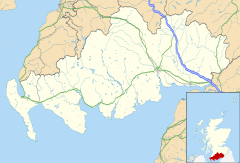
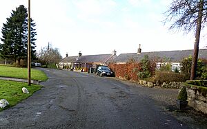
Mennock is a small village or hamlet in southwest Scotland. It's about 2 miles (3.2 km) south-east of Sanquhar in Dumfriesshire. The village is located in the Dumfries and Galloway region.
Mennock started around an old smithy (a place where a blacksmith works) and a corn mill. The main road, the A76, runs right through the middle of the village. In recent years, more houses have been built near the River Nith.
Contents
Mennock's Past
In 1886, the village was called 'Minnock Bridge'. The nearby river was known as 'Minnick Water'. This river starts 7 miles (11 km) away on Lowther Hill and joins the River Nith here. This area is well-known for its connection to the Covenanters. These were Scottish Presbyterians who, in the 17th century, signed agreements (covenants) to defend their religion and church against changes by the king.
Just south of Mennock, a road bridge carries the B797 road. This road goes through the Mennock Pass to Leadhills and Wanlockhead. There used to be a toll house here, where people paid to use the road. A weighing machine was also in the road to weigh carts. By 1898, the toll house was closed.
Mennock School was once near the old entrance to the Mennock Lye Goods Depot. The Mennock War Memorial lists the names of people from the village and those who went to the school who died in World War I.
Glendyne is about 2 miles (3.2 km) from Mennock. It was a secret hiding place for Covenanters who were being hunted. This was because it was very isolated and deep.
In the 1830s, there was a mill on the Mennock Water. By the 1850s, a corn mill was located near the Mennock Viaduct. It had a weir (a small dam) and a ford (a shallow place to cross a river). The miller's house is still there today, but the mill is no longer used.
Eliock House is a historic building on the western bank of the River Nith. The Dalzell family owned it for many years, from around 1388 to 1720. The oldest part of the house is a large tower, likely built in the 16th century. Eliock is believed to be the birthplace of James Crichton. He was known as 'the Admirable Crichton' because he was very skilled in many areas like languages, arts, and sciences. He died in 1582 when he was only 21.
Castle Gilmour (NS822093) once stood near Auchengruith Farm. It was named after the Gilmour family. Today, nothing remains of the castle.
The Cross Kirk of Mennock is a large cross made of stones and earth. It is said to mark the spot of an old chapel. It's located on a flat area of ground at the bottom of Glenclauch Brae.
Getting Around Mennock
Mennock is in Nithsdale, which is a natural path for travel. This is why both roads and railways pass through it. The road from Dumfries to Ayr goes through Mennock on its way to Sanquhar. The Duke of Queensberry built about 22 miles (35 km) of new roads in the area. He also built a road (the B797) through the Mennock Pass towards Edinburgh. Mennock never had its own passenger train station. The closest one today is Sanquhar.
The Dempster Path
This old path starts in the village. It goes under the railway viaduct and past the ruins of a 19th-century corn mill. The path then follows the Mennock Water and crosses the B797 road. The Dempster Path eventually joins the B797 below Middlemoor Hill. This path was marked on old maps as a footpath. It seems it was an alternative route to the B797, which used to be a turnpike road (a road where you paid a toll). The name 'Dempster' suggests it's a very old path. A 'Dempster' was an official in old Scottish courts who announced the sentence.
Mennock Lye Goods Depot
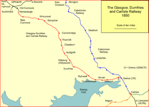
The Mennock Lye Goods Depot was a railway siding that opened in 1850. It was near the Mennock Water and a five-arched viaduct that carries the railway line. This depot was used to transport goods. For example, it moved lime for farms, cattle, horses, sheep, and coal. The Glasgow, Dumfries and Carlisle Railway originally opened these sidings for the Scots Mining Company. This company operated the lead mines in Leadhills and Wanlockhead, about 5 miles (8.0 km) away via the steep Mennock Pass.
The sidings and signal box have been removed over time. Today, only plain double tracks remain. The ruins of the old goods depot office building can still be seen on the western side of the site.
What's in a Name?
The earliest record of the Mennock Water name, from 1660, is 'Minnock'. This name might come from the Scots Gaelic word 'mèineach', which means 'full of ore or mines'. 'Eliock' might come from the Scots Gaelic 'ailcheach', meaning 'stony place'.
Quick Facts
The Leadhills and Wanlockhead Railway has a locomotive (a train engine) named 'Mennock'. This is to honor the connection between the mines and the village. 'Mennock' is a narrow gauge locomotive built in 1994. It was used for tunneling work for the London Olympic Park.
In British English, Mennock is technically a hamlet rather than a village. This is because it has never had its own formal church.
 | Janet Taylor Pickett |
 | Synthia Saint James |
 | Howardena Pindell |
 | Faith Ringgold |


