Mer Rouge, Louisiana facts for kids
Quick facts for kids
Mer Rouge, Louisiana
|
|
|---|---|
|
Village
|
|

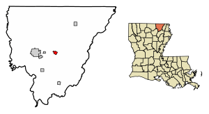
Location in Morehouse Parish, Louisiana
|
|

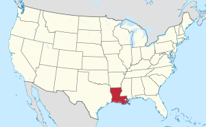
Location of Louisiana in the United States
|
|
| Country | United States |
| State | Louisiana |
| Parish | Morehouse |
| Area | |
| • Total | 1.18 sq mi (3.06 km2) |
| • Land | 1.17 sq mi (3.04 km2) |
| • Water | 0.01 sq mi (0.02 km2) |
| Elevation | 95 ft (29 m) |
| Population
(2020)
|
|
| • Total | 491 |
| • Density | 418.94/sq mi (161.69/km2) |
| Time zone | UTC-6 (CST) |
| • Summer (DST) | UTC-5 (CDT) |
| Area code(s) | 318 |
| FIPS code | 22-49905 |
Mer Rouge is a small village in Morehouse Parish, Louisiana, United States. Its name means "Red Sea" in French. In 2020, about 491 people lived there. This was a decrease from 628 people in 2010.
Contents
History of Mer Rouge
Mer Rouge has a special hill called "Red Hill" near Bastrop. Long ago, French settlers saw a large area of red grass, like a "red sea," between some hills. They named this area "Prairie Mer Rouge," which means "Red Sea Prairie."
During the American Civil War, in 1865, soldiers from Illinois came to Mer Rouge. They took horses and mules and helped free some enslaved people. They also burned a lot of corn and cotton. This made it harder for the people who supported slavery to produce goods.
In 1922, something very sad happened in Mer Rouge. Two local men were taken by members of the Ku Klux Klan. Their bodies were later found in Lake Lafourche. After this event, Louisiana's Governor John M. Parker asked the U.S. government for help to stop the violence caused by the Klan.
Geography and Location
Mer Rouge is located in the middle of Morehouse Parish. It is about 7 miles (11 km) east of Bastrop, which is the main town of the parish. The "Red Hill" mentioned earlier rises about 50 feet (15 meters) above the flat land where Mer Rouge is built. It sits about halfway between Mer Rouge and Bastrop.
Two main highways, U.S. Routes 165 and 425, go through the village. These highways travel together towards Bastrop. However, they split in the center of Mer Rouge. US 165 goes northeast towards Bonita, and US 425 heads south towards Oak Ridge.
The U.S. Census Bureau says that Mer Rouge covers an area of about 1.18 square miles (3.06 square kilometers). Only a very small part of this area, about 0.008 square miles (0.02 square kilometers), is water.
Population Changes
| Historical population | |||
|---|---|---|---|
| Census | Pop. | %± | |
| 1900 | 465 | — | |
| 1910 | 536 | 15.3% | |
| 1920 | 656 | 22.4% | |
| 1930 | 669 | 2.0% | |
| 1940 | 713 | 6.6% | |
| 1950 | 784 | 10.0% | |
| 1960 | 853 | 8.8% | |
| 1970 | 819 | −4.0% | |
| 1980 | 802 | −2.1% | |
| 1990 | 586 | −26.9% | |
| 2000 | 721 | 23.0% | |
| 2010 | 628 | −12.9% | |
| 2020 | 491 | −21.8% | |
| U.S. Decennial Census | |||
The table above shows how the number of people living in Mer Rouge has changed over the years. This information comes from the U.S. Census, which counts the population every ten years.
In 2000, there were 956 people living in Mer Rouge. Most of the people were White (about 63%), and a large group were African American (about 36%). A very small number were Native American or from two or more races.
The average household in Mer Rouge had about 2.28 people. The average family had about 2.86 people. In 2000, about 20% of the population was under 18 years old. About 28% of the people were 65 years old or older. The median age was 45 years.
Famous People from Mer Rouge
- Lou Brock – He was a famous Major League Baseball player and is in the Baseball Hall of Fame.
- Ben Lilly – He was a well-known big game hunter who once owned a farm near Mer Rouge.
- Newt V. Mills – He was a congressman from Louisiana. He taught school in Mer Rouge from 1921 to 1932.
- Samuel W. Mitcham Jr. – He is a writer who focuses on military history. He was born in Mer Rouge.
See also
In Spanish: Mer Rouge para niños
 | William Lucy |
 | Charles Hayes |
 | Cleveland Robinson |

