Middle Harbour facts for kids
Quick facts for kids Middle Harbour |
|
|---|---|

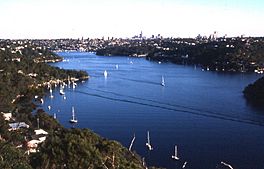
Middle Harbour seen from behind Seaforth Oval.
|
|
| Location | Greater Metropolitan Sydney, New South Wales |
| Coordinates | 33°48′16″S 151°14′58″E / 33.80444°S 151.24944°E |
| Type | Semi-mature tide dominated, drowned valley estuary |
| Native name | Warring-Ga Error {{native name checker}}: parameter value is malformed (help) |
| Part of | Sydney Harbour |
| Primary inflows | Middle Harbour Creek |
| Primary outflows | Port Jackson |
| Catchment area | 100 km2 (39 sq mi) |
| Basin countries | Australia |
| Max. length | 10 km (6.2 mi) |
Middle Harbour, also known as Warring-Ga, is a special type of waterway. It is a drowned valley estuary. This means it's a river valley that was filled with seawater. It is the northern part of Port Jackson, which is also called Sydney Harbour.
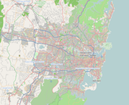
Middle Harbour is located north of the main city area of Sydney, in New South Wales, Australia. It connects to the Tasman Sea.
The harbour starts as Middle Harbour Creek in Garigal National Park. It flows southeast for about 10 kilometers. It then joins Port Jackson between Grotto Point and Middle Head. The area of land that drains water into Middle Harbour is about 100 square kilometers.
Contents
Exploring Middle Harbour's Features
The Waterway's Path
The shores of Middle Harbour are mostly rough and covered with bushland. Because of this, people did not develop much of the area for a long time. There are only a few small flat areas along its edges. Many small creeks flow into the harbour from the surrounding hills. However, no large rivers empty into Middle Harbour.
As you travel along Middle Harbour, you will find many smaller bays. These include Shell Cove, Pearl Bay, and Long Bay. Other bays are Sugarloaf Bay, Bantry Bay, and Fisher Bay. You can also find Sandy Bay, Sailors Bay, Powder Hulk Bay, Willoughby Bay, and Quakers Hat Bay.
A Natural Barrier
Middle Harbour acts as a big natural barrier. It separates the main part of Sydney from the suburbs known as the Northern Beaches area. These suburbs are located north and east of the harbour.
There are only two bridges that cross Middle Harbour. These are the Spit Bridge and the Roseville Bridge. Because of this, people used to travel between Manly and Sydney mostly by ferry.
Life Around the Harbour
Since the 1920s, many homes have been built on the hilltops around Middle Harbour. However, much of the rugged shoreline is still covered with natural bushland. Most of this bushland is now protected in parks and reserves. Middle Harbour is a popular spot for fun activities. People enjoy boating and fishing in its waters.
 | James Van Der Zee |
 | Alma Thomas |
 | Ellis Wilson |
 | Margaret Taylor-Burroughs |


