
Garigal National Park facts for kids
Quick facts for kids Garigal National ParkNew South Wales |
|
|---|---|
|
IUCN Category II (National Park)
|
|

View of the national park from Middle Harbour
|
|
| Nearest town or city | Sydney |
| Established | 19 April 1991 |
| Area | 22.02 km2 (8.5 sq mi) |
| Managing authorities | NSW National Parks & Wildlife Service |
| Website | Garigal National Park |
| See also | Protected areas of New South Wales |

Brushturkey_Garigal_National_Park.jpg)

The Garigal National Park is a special protected area near Sydney, New South Wales, in eastern Australia. It's about 20 kilometers north of the city center. This national park covers a huge area of 2,202 hectares.
The park is split into three main parts. These parts include the beautiful Middle Harbour Creek valley, the hills along Middle Harbour, and areas near Narrabeen Lakes.
Many people love to visit Garigal National Park for outdoor activities. It's a popular spot for bushwalking and mountain biking. There are over 35 trails in the park, stretching for 120 kilometers. Some trails are official, while others are unofficial paths.
Contents
Garigal National Park: History and Culture
The name Garigal comes from the word Carigal or Caregal. This word was used to describe the Aboriginal people who lived in the area. Today, this area is known as Ku-ring-gai country.
The Guringai people are the traditional owners of the land that is now Garigal National Park. There is a lot of proof that Aboriginal people lived here long ago. Over 100 Aboriginal sites have been found in the park. These sites include rock shelters, cave art, rock engravings, and places where they prepared food.
Exploring Garigal National Park: Location and Access
Garigal National Park is surrounded by homes and towns. This makes it easy to reach by road and even by water in many places.
Several other nature reserves are close to Garigal National Park. These include the Ku-ring-gai Chase National Park and the Sydney Harbour National Park. There are also other bushland areas managed by local councils like Northern Beaches, Ku-ring-gai, and Willoughby.
The park has different boundaries in its various sections:
- In the north-east, it's south of Mona Vale Road and the Belrose Waste Management Centre. It stretches east towards Elanora Heights, Ingleside, and the Narrabeen Lakes.
- In the south-west, it follows Middle Harbour and Middle Harbour Creek. It's bordered by towns like Killarney Heights, Forestville, and St Ives. It goes north to Mona Vale Road, where it meets Ku-ring-gai Chase National Park.
- In the south-east, it surrounds Bantry Bay. This area is between Killarney Heights and Forestville to the west, and Wakehurst Parkway and the Manly Dam Reserve to the east.
Wildlife and Nature in Garigal National Park
Garigal National Park is mostly a Dry Sclerophyll Forest. This type of forest has tough, often spiky, leaves that help plants survive dry conditions.
Animals of Garigal National Park
The park is home to many different animals. You can find various birds and snakes here. There are also many native mammals, such as bandicoots, koalas, and wallabies.
Unfortunately, some animals that are not native to Australia, like rabbits and foxes, also live in the park. These are called introduced pests.
Gallery
-
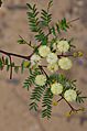
Acacia terminalis


.jpg)

.jpg)
See also
 In Spanish: Parque nacional Garigal para niños
