Milecastle 49 facts for kids
Quick facts for kids Milecastle 49 |
|
|---|---|

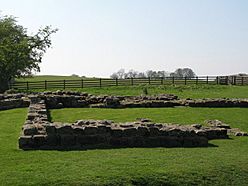
The remains of Milecastle 49
|
|
| Type | Milecastle |
| Place in the Roman world | |
| Province | Britannia |
| Structure | |
| — Stone structure — | |
| Size and area | 19.8 m × 22.9 m (0.04 ha) |
| Location | |
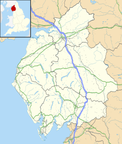
| Coordinates | 54°59′27″N 2°35′42″W / 54.990793°N 2.594987°W |
| County | Cumbria |
| Country | England |
Milecastle 49 (Harrows Scar) was a small fort, known as a milecastle, built by the Romans on Hadrian's Wall. These milecastles were like mini-forts placed about one Roman mile apart along the wall. They helped control movement and guarded the frontier.
About Milecastle 49
Milecastle 49 is located just west of the River Irthing gorge. Here, Hadrian's Wall crossed the river using a bridge at Willowford. The nearby cliff, or "scar," and the milecastle itself are named after an old farm called The Harrows.
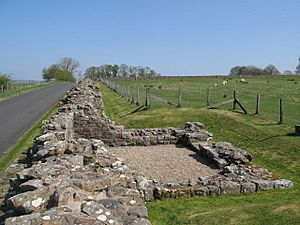
This milecastle measures about 19.8 meters (65 feet) from east to west and 22.9 meters (75 feet) from north to south. Today, you can't see any of the original buildings inside it. It was built using strong stone walls that were connected to the main stone wall of Hadrian's Wall on both sides. It also had a specific type of entrance gate, known as a Type III gateway.
Milecastle 49 is positioned 1458 meters (about 0.9 miles) west of Milecastle 48. It is also 1391 meters (about 0.86 miles) east of Milecastle 50. This shows how regularly spaced these forts were along the wall.
Today, this important historical site is looked after by English Heritage. It was officially recognized as a Scheduled Monument in 1997, meaning it's protected by law.
Discoveries and Digs
Archaeologists have dug at Milecastle 49 twice. The first excavation happened in 1898. Later, in 1953, a famous archaeologist named Ian Richmond led another dig. During his work, parts of an even older milecastle were found underneath. This older structure was part of the original "Turf Wall," which was built before the stone wall.
Guard Towers (Turrets)
Every milecastle on Hadrian's Wall had two smaller guard towers, called turrets, connected to it. These turrets were usually placed about one-third and two-thirds of a Roman mile to the west of the milecastle. Soldiers from the milecastle would have likely manned these turrets. The turrets linked to Milecastle 49 are called Turret 49A and Turret 49B.
Turret 49A
Turret 49A was built when the original turf (grass and earth) wall was constructed. This turret was later taken down when the Roman fort at Birdoswald was built nearby. In 1945, during investigations, some signs of this turret were found. However, there are no visible remains of Turret 49A today.
Turret 49B
Turret 49B is located about 340 meters (1,115 feet) west of the Birdoswald fort. It was excavated in 1911. The stone remains of this turret have been preserved and are now visible to visitors. This stone turret replaced an earlier turf wall turret (49B TW), which was removed when the stone wall was built.
 | Roy Wilkins |
 | John Lewis |
 | Linda Carol Brown |


