Milecastle 52 facts for kids
Quick facts for kids Milecastle 52 |
|
|---|---|
| Type | Milecastle |
| Location | |
| Coordinates | 54°58′37″N 2°39′31″W / 54.976967°N 2.658574°W |
| County | Cumbria |
| Country | England |
Milecastle 52 (Bankshead) was a small fort, called a milecastle, built along Hadrian's Wall. This famous wall was a huge defensive barrier built by the Romans in ancient Britain.
Contents
What is Milecastle 52?
Milecastle 52 is located west of the Birdoswald fort. It sits about 1,484 meters west of Milecastle 51. It is also 1,520 meters east of Milecastle 53. Today, a house and garden stand where the milecastle once was. You can't see any parts of the original milecastle now.
Uncovering History: What We Found
Archaeologists dug up Milecastle 52 in 1934. Even though it's not visible today, the digging showed its size. It measured about 27.5 meters from east to west. It was 23.4 meters from north to south. The milecastle had special gates known as Type III gateways.
This stone milecastle was built on top of an older one. The first milecastle, called Milecastle 52TW, was part of the Turf Wall. This was an earlier version of Hadrian's Wall made of earth and turf.
In 1808, two altars were found here. These altars were dedicated to a local god named Cocidius. One altar was set up by soldiers from the Twentieth Legion. This happened between the years 262 and 266. Later, in 1862, a broken stone slab was discovered. It had the name of the Roman Emperor Hadrian on it.
Guard Towers: Turrets 52A and 52B
Every milecastle along Hadrian's Wall had two smaller guard towers. These towers are called turrets. They were placed about one-third and two-thirds of a Roman mile to the west. Soldiers from the milecastle likely guarded these turrets. The towers connected to Milecastle 52 are Turret 52A and Turret 52B.
Turret 52A: The Visible Tower
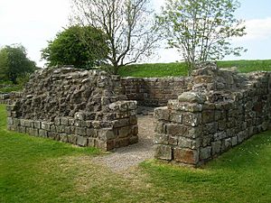
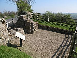
Turret 52A (Banks East) is located near the road east of Banks village. Digs in 1933 found parts of the old Turf Wall next to its east side. This turret was used from the early 2nd century until at least the late 3rd century. Its entrance was on the southeast side. Inside, archaeologists found traces of two fireplaces. There was also a low bench along the northwest wall.
The walls of the turret have been made strong again. They stand up to 1.75 meters high. In 1934, this turret became the first part of Hadrian's Wall to be protected by the government.
Turret 52B: The Missing Tower
Turret 52B has never been found. Its likely spot has been guessed based on Turret 52A and Milecastle 53. It might be hidden underneath the modern road that exists today.
Pike Hill Signal Tower: An Even Older Structure!
The remains of Pike Hill Signal Tower are about 170 meters east of Turret 52A. Most of this signal tower has been destroyed by the modern road. However, a small piece of its southeast wall remains. It is 2 meters long and 0.8 meters wide. This piece is south of the road.
This signal tower is very interesting because it is older than Hadrian's Wall itself. The wall was later built around it. The tower's remains are at a 45-degree angle to the wall. The tower had very deep foundations. This suggests it was built extra tall for sending signals.
 | Aurelia Browder |
 | Nannie Helen Burroughs |
 | Michelle Alexander |


