Milecastle 51 facts for kids
Quick facts for kids Milecastle 51 |
|
|---|---|

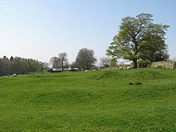
The site of Milecastle 51
|
|
| Type | Milecastle |
| Place in the Roman world | |
| Province | Britannia |
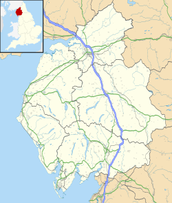
| Location | |
| Coordinates | 54°58′57″N 2°38′15″W / 54.982382°N 2.637411°W |
| County | Cumbria |
| Country | England |
Milecastle 51 (Wall Bowers) was a small fort, called a milecastle, that was part of the famous Hadrian's Wall in ancient Britannia. These milecastles were like mini-forts built along the wall, usually about one Roman mile apart.
About Milecastle 51
Milecastle 51 is located west of a larger Roman fort called Birdoswald. It's a special spot because this is where the main stone part of Hadrian's Wall met back up with an older section made of turf (grass and earth).
It was built about 1,501 meters (nearly a mile) west of Milecastle 50 and 1,484 meters east of Milecastle 52. Today, not much is left of Milecastle 51. You can mostly see its foundations, which are covered by grass. There are also hints of a ditch on its eastern side.
Digging Up the Past
Archaeologists dug up Milecastle 51 several times, in 1927, 1934, and 1936. Even though you can't see them now, these digs showed that the milecastle had two stone barracks buildings inside. These were where the Roman soldiers would have slept.
The stone milecastle we see today was built on top of an older one. The first Milecastle 51 was made of turf, but it was later replaced by a stronger stone version.
Helper Turrets
Each milecastle along Hadrian's Wall had two smaller watchtowers, called turrets, nearby. These turrets were placed about one-third and two-thirds of a Roman mile to the west of the milecastle. Soldiers from the milecastle would have guarded these turrets. The turrets connected to Milecastle 51 are known as Turret 51A and Turret 51B.
Turret 51A
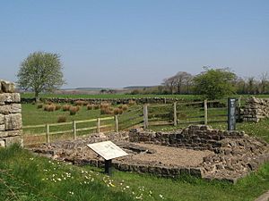
Turret 51A (Piper Sike) was first built as a turf turret, like the original wall, and then later rebuilt using stone. Archaeologists excavated this turret in 1927 and again in 1970.
They found that the entrance was on the east side. There was also a strong platform built against the north wall. Inside, they discovered cooking hearths and scattered rubbish, showing that soldiers lived and cooked there. It's believed that people stopped using this turret after the 2nd century AD. After the 1970 excavation, the turret was made stronger (consolidated) and still stands up to 0.8 meters (about 2.6 feet) high.
Turret 51B
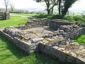
Turret 51B (Leahill) measures about 4.1 by 4.3 meters (about 13.5 by 14.1 feet). It was excavated in 1927 and again in 1958. Like Turret 51A, it replaced an earlier turret that was made of turf. The stone turret has been made stronger (consolidated) and stands up to 1.1 meters (about 3.6 feet) high today.
 | Janet Taylor Pickett |
 | Synthia Saint James |
 | Howardena Pindell |
 | Faith Ringgold |


