
Milvignes facts for kids
Quick facts for kids
Milvignes
|
||
|---|---|---|
|
||

Milvignes
Location in Switzerland

Milvignes
Location in Canton of Neuchâtel
|
||
| Country | Switzerland | |
| Canton | Neuchâtel | |
| Area | ||
| • Total | 8.78 km2 (3.39 sq mi) | |
| Elevation | 457 m (1,499 ft) | |
| Population
(Dec 2020 )
|
||
| • Total | 9,063 | |
| • Density | 1,032.2/km2 (2,673.5/sq mi) | |
| Postal code |
2012 - 2014
|
|
| Localities | Auvernier, Bôle and Colombier | |
| Surrounded by | Rochefort, Corcelles-Cormondrèche, Peseux, Neuchâtel, Boudry | |

Milvignes is a town, also called a municipality, in the canton of Neuchâtel in Switzerland. It was created on January 1, 2013. This happened when three smaller towns – Auvernier, Bôle, and Colombier – joined together.
Contents
History of Milvignes
Auvernier's Past
Auvernier was first mentioned in old writings in the year 1011. Back then, it was called Averniacum. It also had a German name, Avernach, but that name is not used anymore.
Bôle's Beginnings
Bôle first appears in historical records in 1346. At that time, it was known as Boule.
Colombier Through Time

Colombier was first written about in 1228 as Columbier.
Scientists have found four ancient settlements near the lake in Colombier. These settlements date back to the neolithic (New Stone Age) and the Bronze Age. This shows people lived here a very long time ago!
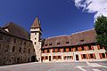
One of the biggest Roman era (when the Roman Empire was powerful) houses in Switzerland was found under the castle in 1840–42. It was like a huge palace built between the 1st and 3rd centuries AD. It had fancy courtyards, at least two bath areas with beautiful mosaics and wall paintings, and even gardens on different levels. A very old graveyard from the Merovingian period (an early French kingdom) was also found nearby.
Around the 11th or 12th century, a strong tower was built over the old Roman house ruins. It grew bigger in the 13th century. By the 16th century, it looked much like it does today. This building is now known as Colombier Castle.
During the Middle Ages, the Seigneurie (a lord's land) of Colombier was quite large. It included Colombier, Areuse, part of Bôle, and a third of the Bevaix area. The noble Colombier family were vassals, meaning they served the count of Neuchâtel. They also gained more land through marriages.
In 1488, the de Chauvirey family took over the Colombier lands. Then, in 1513, Johann Jakob von Watteville from Bern bought them. He helped the Protestant Reformation (a big change in Christianity) come to the town. Later, in 1564, the Counts of Neuchâtel bought the land for a lot of money.
The exact borders of the village were first written down in 1346. In 1357, Colombier, Bôle, and Areuse were given a forest to share and manage together. For a long time, many people in the town didn't have to pay as many feudal taxes (old taxes paid to a lord). But the last of these taxes were finally removed in the 1800s.
In the mid-1600s, the town was saved from going bankrupt (running out of money) by a loan from bankers. In 1657, the Prince of Neuchatel, Henri II d'Orléans, even cleared the town's debts. In return, the town promised to plant trees along the road from the lake to the castle.
A small church, called a chapel, was first mentioned in Colombier in 1177. It became a larger church area, called a parish, before 1228. This parish included other nearby villages for a while. A Catholic parish was started in 1884.
In 1734, the first factory for spinning thread was built in Colombier. By 1739, it had about 80 workers. This factory brought wealth to the town. It allowed people to build grand country houses nearby.
In 1806, Colombier Castle was turned into a military hospital. From 1824, it was used by the Swiss army for training. It became a barracks (a place where soldiers live) and had a bigger weapons storage area. In 2003, the army changed its structure, and in 2004, the barracks became a training center for infantry (foot soldiers).
In the 1800s, Colombier became an important local center. It had a gas plant and a bank. The first train station was built in 1859–60. In 1892, a tram line (a streetcar) connected it to Neuchâtel and Boudry. An airfield (a small airport) was built in 1927. A regional high school was built in 1969. Today, Milvignes is mostly a residential area, meaning people live there, and many jobs are linked to the army training center.
Geography of Milvignes
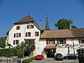
20110831_1782_HDR.jpg)
The former towns that now make up Milvignes cover a total area of about 8.79 square kilometers (about 3.4 square miles).
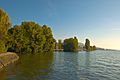
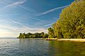
Auvernier is located on the northwest side of Lake Neuchâtel. About 47% of its land is used for farming. A small part (3.6%) is covered by forests. Most of the rest (47.6%) has buildings or roads. A tiny bit is rivers or lakes.
Bôle is on a slope above an old Roman road. About 27% of its land is used for farming. A large part (45%) is forested. The rest (28.3%) has buildings or roads. Bôle is a linear village, meaning its houses are mostly built along a single road.
Colombier is on a small hill above Lake Neuchâtel. About 39.4% of its land is used for farming. About 18.8% is forested. The largest part (41.2%) has buildings or roads.
Before 2018, Milvignes was part of the Boudry area. But now, Switzerland has changed its system, and districts are no longer used.
Population of Milvignes
The total population of Milvignes is 8,887 people.
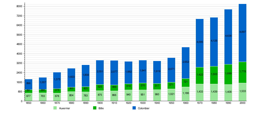
Historic Population Trends
The chart below shows how the population of Auvernier, Bôle, and Colombier changed over many years before they merged into Milvignes.
Getting Around Milvignes
Milvignes has three train stations: Auvernier, Colombier NE, and Bôle. The first two are on the Jura Foot line. Bôle is on the Neuchâtel–Pontarlier line. These stations offer regular train services to places like Yverdon-les-Bains, Neuchâtel, and Buttes.
The town also has a tram line, called the Littorail, which connects Boudry and Neuchâtel. Trams are like streetcars that run on tracks in the road.
Important Historical Sites
Milvignes is home to several important historical places. These are recognized as Swiss heritage sites of national significance.
In Auvernier, the ancient lake shore settlement at Baie D‘Auvernier and Auvernier Castle are very important.
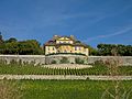
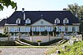
In Colombier, the Arsenal (a place for military weapons), the prehistoric lake shore settlement at Baie d'Auvernier, Colombier Castle with its museum, and the old Roman villa are all significant. Other important sites include the Domaine de Vaudijon, the House de maître du Bied, and the Manoir Le Pontet.
The entire old village of Colombier, the village of Auvernier, and the Areuse region are also part of the Inventory of Swiss Heritage Sites. This means they are protected for their historical value.
World Heritage Site
Milvignes is also special because it has two prehistoric pile-dwelling (or stilt house) settlements: La Saunerie and Les Graviers. These are part of the Prehistoric pile dwellings around the Alps which is a UNESCO World Heritage Site. This means they are recognized globally as very important historical places.
Images for kids
-
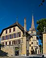
Auvernier Castle
-
Site of the Baie d'Auvernier prehistoric settlement
-
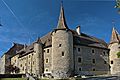
Colombier Castle
-
The prehistoric lake shore settlement at Baie d‘Auvernier
-
Colombier Castle
-
Domaine de Vaudijon
-
House de maître du Bied
-
Manoir Le Pontet

20110831_1777_HDR.jpg)

20110831_1772_HDR.jpg)


See also
 In Spanish: Milvignes para niños
