Minsmere River facts for kids
Quick facts for kids Minsmere |
|
|---|---|

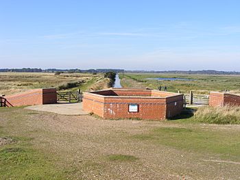
Minsmere sluice at the seaward end of Minsmere New Cut
|
|
|
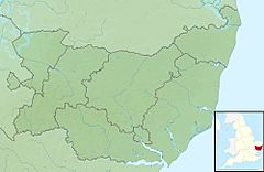
Location of the river mouth within Suffolk
|
|
| Country | England |
| Region | Suffolk |
| Physical characteristics | |
| Main source | Ubbeston parish 52 m (171 ft) 52°09′18″N 0°44′10″E / 52.1551°N 0.7361°E |
| River mouth | North Sea 0 m (0 ft) 52°14′14″N 1°37′43″E / 52.2373°N 1.6286°E |
The Minsmere River is a river found in the English county of Suffolk. It flows into the North Sea at a place called Minsmere. This river starts when the River Yox joins it near Yoxford.
From there, the Minsmere River flows through several villages. These include Middleton, Eastbridge, and Minsmere itself. The river runs just south of the famous Minsmere RSPB reserve. It helps create many of the wet areas and habitats at this important nature reserve.
In the past, the river valley was mostly drained. This land was then used for farming. The original path of the river, called the Minsmere Old River, is north of the Minsmere New Cut. The New Cut is an artificial channel built in 1812 to help drain water. It reaches the sea at the Minsmere Sluice, which is a special gate that lets water out into the sea.
Contents
Protecting the Minsmere River from Floods
Sometimes, the drainage channels and river banks around Minsmere can flood. To stop this, work has been done to protect the area. Flood defence projects have been carried out on the New Cut and its sluices. Work has also been done at Reckford Bridge in Middleton to prevent flooding there.
Exploring the Minsmere River Landscape
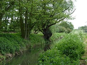
The area between Yoxford and Eastbridge is known for its valley meadows and fens. A fen is a type of wetland. This narrow valley has some peat deposits, which are layers of decaying plant material. Most of this land is drained by a system of small channels called dykes. It is used as grassland, with some areas of mixed woodland.
The Suffolk Wildlife Trust manages a nature reserve here. It is called Darsham Marshes and covers about 20 hectares (50 acres). This reserve is located along this part of the river.
Minsmere Levels: A Unique Wetland Area
After Eastbridge, the land along the river becomes very flat. This flat area is known as the Minsmere Level. It is a special place that was once marshland. It has been drained and then re-flooded to create important habitats. The ground underneath is made of alluvial geology, which means it has soil deposited by water.
The area south of the Minsmere New Cut is used for grazing animals. To the north, the wet areas are flooded on purpose. They are managed by the RSPB as part of their plan for the Minsmere reserve. This management helps create perfect homes for many birds and other wildlife.
Wildlife Living in the Minsmere Wetlands
The Minsmere area provides important homes for many different animals. You might spot rare birds like bitterns, marsh harriers, and hen harriers. Other birds that live here include avocets and Dartford warblers.
The wetland areas have flooded lagoons, which are shallow pools of water. Much of this area is a Ramsar site. This means it is a wetland of international importance. The grazing marshes south of the Minsmere Levels are also vital. They provide a place for many different types of waterfowl to spend the winter.
Discovering Minsmere's Past: Archaeology
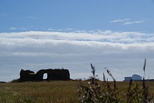
The original site of Leiston Abbey was once located south of the river. It stood on the Minsmere Levels. Today, only the remains of a chapel can be seen at this first abbey site. The abbey was home to a group of monks called Premonstratensians.
The abbey was moved to its current location near Leiston in 1363. This was because the coastal site was flooding more and more often. The chapel you see today was built after the abbey moved. It was used until 1536, when monasteries were closed down. This chapel is now a scheduled monument, which means it is a nationally important historical site.
Eastbridge Windpump: A Piece of History
The Eastbridge Windpump was one of four drainage mills that stood on the Minsmere Levels. These mills worked alongside the river to help drain the land. This particular windpump has been preserved. You can now see it at the Museum of East Anglian Life in Stowmarket.
 | James Van Der Zee |
 | Alma Thomas |
 | Ellis Wilson |
 | Margaret Taylor-Burroughs |


