Mixco facts for kids
Quick facts for kids
Mixco
|
|||
|---|---|---|---|
 |
|||
|
|||
| Motto(s):
Land of champions Spanish: Tierra de campeones
|
|||
| Country | |||
| Department | Guatemala | ||
| Area | |||
| • Total | 37.0 sq mi (95.9 km2) | ||
| Elevation | 5,548 ft (1,691 m) | ||
| Population
(census 2018)
|
|||
| • Total | 465,773 | ||
| • Density | 12,579/sq mi (4,856.9/km2) | ||
| Climate | Cwb | ||
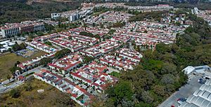
Mixco is a large city and a special area called a "municipality" in Guatemala. It's located right next to Guatemala City, which is the capital. Mixco is so close that it's now part of the bigger Guatemala City Metropolitan Area.
Many parts of Mixco are separated from Guatemala City by deep canyons. Because of this, many bridges have been built to connect the areas. Mixco is the second-largest city in Guatemala, with over 475,000 people living there. A well-known area called Ciudad San Cristóbal is also part of Mixco.
Contents
How Mixco is Organized

The Mixco municipality is divided into different areas. These include residential neighborhoods, smaller villages, and the main city center. Since Mixco is very close to Guatemala City, some of its villages have grown into busy neighborhoods.
| Settlement | List |
|---|---|
| Villages |
|
| Residential neighborhoods |
|
One neighborhood, "La Florida," used to be part of Mixco. However, in 1958, it became part of Guatemala City instead.
City Leaders
The mayor is the main leader of a city or municipality. Here are the people who have been elected as mayor of Mixco since 1986:
| Mayor | Time in office | Party |
|---|---|---|
| Juan Guillermo Gómez Valdéz | 15 January 1986 - 15 January 1991 | Democracia Cristiana |
| Víctor Manuel Herrera | 15 January 1991 - 15 January 1996 | Partido de Avanzada Nacional |
| Édgar Abraham Rivera | 15 January 1996 - 15 January 2000 | Partido de Avanzada Nacional |
| 15 January 2000 - 15 January 2004 | Frente Republicano Guatemalteco | |
| Amílcar Rivera | 15 January 2004 - 15 January 2008 | Partido de Avanzada Nacional |
| 15 January 2008 - 15 January 2012 | Partido Patriota | |
| Otto Pérez | 15 January 2012 - 15 January 2016 | Partido Patriota |
| Neto Bran | 15 January 2016 - 15 January 2020 | Movimiento Reformador |
Learning Opportunities
Mixco is home to several universities where students can continue their education after high school:
- UruralG
- UPANA
- USAC
- URL
Sports in Mixco
The city has its own football (soccer) team called Deportivo Mixco. They play in the Guatemalan second division, which is a professional league. The team plans to build a new stadium called Estadio de La Tierra de Campeones.
Mixco in Movies
In 1969, a movie called El ogro was filmed in Mixco. This film starred a famous Mexican comedian, Germán Valdéz, and Guatemalan actor Herbert Meneses. Scenes shot in Mixco showed Germán Valdéz as an old church keeper telling stories to children.
Mixco's Climate
Mixco has a type of climate called a subtropical highland climate. This means it has mild temperatures all year round. It's often described as a "spring-like" climate.
| Climate data for Mixco | |||||||||||||
|---|---|---|---|---|---|---|---|---|---|---|---|---|---|
| Month | Jan | Feb | Mar | Apr | May | Jun | Jul | Aug | Sep | Oct | Nov | Dec | Year |
| Mean daily maximum °C (°F) | 22.3 (72.1) |
23.4 (74.1) |
24.8 (76.6) |
25.3 (77.5) |
24.9 (76.8) |
23.4 (74.1) |
23.4 (74.1) |
23.7 (74.7) |
23.0 (73.4) |
22.4 (72.3) |
22.3 (72.1) |
22.2 (72.0) |
23.4 (74.1) |
| Daily mean °C (°F) | 16.4 (61.5) |
17.1 (62.8) |
18.2 (64.8) |
19.1 (66.4) |
19.3 (66.7) |
18.9 (66.0) |
18.7 (65.7) |
18.7 (65.7) |
18.4 (65.1) |
17.9 (64.2) |
17.2 (63.0) |
16.5 (61.7) |
18.0 (64.5) |
| Mean daily minimum °C (°F) | 10.6 (51.1) |
10.9 (51.6) |
11.7 (53.1) |
13.0 (55.4) |
13.8 (56.8) |
14.5 (58.1) |
14.1 (57.4) |
13.8 (56.8) |
13.9 (57.0) |
13.5 (56.3) |
12.2 (54.0) |
10.9 (51.6) |
12.7 (54.9) |
| Average precipitation mm (inches) | 2 (0.1) |
1 (0.0) |
2 (0.1) |
31 (1.2) |
124 (4.9) |
239 (9.4) |
202 (8.0) |
194 (7.6) |
226 (8.9) |
128 (5.0) |
22 (0.9) |
7 (0.3) |
1,178 (46.4) |
| Source: Climate-Data.org Instituto Nacional de Sismología, Vulcanología, Meteorología e Hidrología de Guatemala |
|||||||||||||
Where Mixco is Located
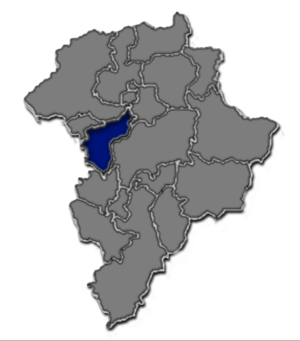
Mixco is surrounded by other cities and departments in Guatemala. This map shows its neighbors:
 |
San Pedro Sacatepéquez, municipality of Guatemala Department |  |
||
| Sacatepéquez Department, department of Guatemala | Chinautla and Guatemala City, municipalities of Guatemala Department | |||
| Villa Nueva, municipality of Guatemala Department | Ciudad de Guatemala, capital of Guatemala and municipality of Guatemala Department |
See Also
 In Spanish: Mixco para niños
 | Janet Taylor Pickett |
 | Synthia Saint James |
 | Howardena Pindell |
 | Faith Ringgold |


