Monroe, Ohio facts for kids
Quick facts for kids
Monroe, Ohio
|
|||||
|---|---|---|---|---|---|

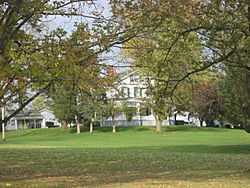
Hughes Manor
|
|||||
|
|||||
| Motto(s):
"Firmly Founded - Proudly Growing"
|
|||||

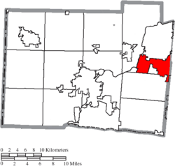
Location of Monroe in Butler County
|
|||||
| Country | United States | ||||
| State | Ohio | ||||
| Counties | Butler, Warren | ||||
| Area | |||||
| • Total | 15.91 sq mi (41.22 km2) | ||||
| • Land | 15.89 sq mi (41.16 km2) | ||||
| • Water | 0.02 sq mi (0.06 km2) | ||||
| Elevation | 820 ft (250 m) | ||||
| Population
(2020)
|
|||||
| • Total | 15,412 | ||||
| • Density | 969.92/sq mi (374.48/km2) | ||||
| Time zone | UTC-5 (Eastern (EST)) | ||||
| • Summer (DST) | UTC-4 (EDT) | ||||
| ZIP codes |
45050, 45044 (pt), 45073, 45099
|
||||
| Area code(s) | 513 | ||||
| FIPS code | 39-51310 | ||||
| GNIS feature ID | 2395374 | ||||
| Website | City website | ||||
Monroe is a city located in the southwestern part of Ohio, a state in the United States. It sits across two counties: Butler and Warren. In 2020, about 15,412 people lived there. Monroe is also part of the larger Cincinnati metropolitan area, which is a big group of cities and towns connected together.
Contents
History of Monroe, Ohio
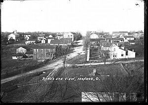
Monroe was first planned and settled in 1817. It was built along an important road that connected the cities of Dayton and Cincinnati. The city gets its name from James Monroe, who was the fifth President of the United States.
In the early 1830s, Monroe was quite small. It had only one store and about 119 people living there. It has grown a lot since then!
Geography of Monroe
Monroe covers a total area of about 15.89 square miles (41.16 square kilometers). Most of this area is land, with only a tiny bit being water. This information comes from the United States Census Bureau.
Population Changes in Monroe
| Historical population | |||
|---|---|---|---|
| Census | Pop. | %± | |
| 1850 | 198 | — | |
| 1870 | 324 | — | |
| 1880 | 365 | 12.7% | |
| 1910 | 255 | — | |
| 1920 | 266 | 4.3% | |
| 1930 | 285 | 7.1% | |
| 1940 | 307 | 7.7% | |
| 1950 | 360 | 17.3% | |
| 1960 | 2,193 | 509.2% | |
| 1970 | 3,492 | 59.2% | |
| 1980 | 4,256 | 21.9% | |
| 1990 | 4,490 | 5.5% | |
| 2000 | 7,133 | 58.9% | |
| 2010 | 12,442 | 74.4% | |
| 2020 | 15,412 | 23.9% | |
| 2021 (est.) | 15,448 | 24.2% | |
| Sources: | |||
Monroe's Population in 2010
In 2010, there were 12,442 people living in Monroe. These people lived in 4,649 homes, and 3,481 of these were families. The city had about 784 people living in each square mile.
The average age of people in Monroe in 2010 was about 36.9 years old. About 27% of the residents were under 18 years old. Also, about 14.3% of the people were 65 years old or older.
Schools and Services in Monroe
Most students in Monroe attend schools in the Monroe Local School District. Some parts of the city are also served by the Lakota Local School District.
For communication, telephone service is available through different areas, including Monroe, Middletown, and Mason. Mail is delivered by post offices in Monroe, Middletown, and Lebanon.
The city also has important public safety services. There is a police station and a fire station located on Main Street. The main fire department headquarters is on Route 4.
Things to See in Monroe
- Lux Mundi statue: This is a large statue that replaced an older one called "King of Kings." The original "King of Kings" statue was very famous and was sometimes called "Touchdown Jesus" or "Big Butter Jesus." It was unfortunately damaged in 2010 and later replaced by the "Lux Mundi" statue.
See also
 In Spanish: Monroe (Ohio) para niños


