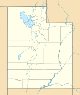
Monte Cristo Range (Utah) facts for kids
Quick facts for kids Monte Cristo Range (Utah) |
|
|---|---|
| Highest point | |
| Peak | Mt McKinnon ((south terminus)-Monte Cristo Range) |
| Elevation | 9,081 ft (2,768 m) |
| Dimensions | |
| Length | 30 mi (48 km) SSW x NNE |
| Geography | |
| Country | United States |
| Settlements | Randolph and Laketown |
| Range coordinates | 41°35.11′N 111°30.05′W / 41.58517°N 111.50083°W |
The Monte Cristo Range is a mountain range in Utah, United States. It stretches for about 30 miles (48 km) in the far northeast part of the state. This range runs in the same direction as the Bear River Mountains to its west. However, it is only about half as long.
The Monte Cristo Range runs from the south-southwest to the north-northeast. It also runs parallel to a part of the Bear River that flows north. Towns like Woodruff and Randolph are located on the west bank of the river. These towns are right next to the eastern foothills of the Monte Cristo Range.
The main ridgeline of the range forms the border between two counties. Cache County is on the west side, and Rich County is on the east side.
Contents
Exploring the Monte Cristo Range
The Monte Cristo Range is about 30 miles (48 km) long. Its main ridge is located a bit to the west of the center. This means there are many foothills stretching eastward toward the Bear River valley.
On the western side of the range, you'll find Ant Valley. This valley borders the Bear River Range to the west. It covers a large part of the western foothills, from the center to the south.
Tallest Peaks in the Range
The Monte Cristo Range has several notable peaks. Here are some of the higher ones:
- Red Spur Mountain: This peak is located north of the range's center. It stands tall at 8,872 feet (2,704 meters).
- Gold Hill: You can find Gold Hill west of the range's center. It reaches an elevation of 8,106 feet (2,471 meters).
- Eccles Peak: This peak is in the far southeast part of the range. It is 9,062 feet (2,762 meters) high.
- Mt McKinnon: This is the highest point in the entire range. It is located at the very southern end of the range. Mt McKinnon reaches an impressive height of 9,081 feet (2,768 meters).
Visiting the Monte Cristo Range
It's easy to access and explore the Monte Cristo Range.
Roads and Trails
Utah State Route 101 is a road that crosses the Bear River Range. It starts from Hyrum and leads to the central-west part of the Monte Cristo Range. This road will take you right into Ant Valley.
Hardware Ranch Wildlife Management Area
In Ant Valley, you'll find the Hardware Ranch WMA. This is a special area where you can see wildlife. It's a great place to visit if you love nature!
Another road, Ant Flat Road, connects with Utah State Route 101. It goes through the southwest part of the range. This road then meets Utah 39. Utah 39 also travels through a southern part of the range. From the southeast foothills, Utah 39 turns northeast and heads towards Woodruff. Woodruff is about 18 miles (29 km) from the range.
 | Georgia Louise Harris Brown |
 | Julian Abele |
 | Norma Merrick Sklarek |
 | William Sidney Pittman |


