Bear River Range facts for kids
Quick facts for kids Bear River Range |
|
|---|---|

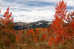
Autumn aspens in the Bear River Range
|
|
| Highest point | |
| Peak | Naomi Peak (Cache County, Utah & Mount Naomi Wilderness) |
| Elevation | 9,979 ft (3,042 m) |
| Dimensions | |
| Area | 1,615 sq mi (4,180 km2) |
| Naming | |
| Etymology | Bear River |
| Geography | |
| Country | United States |
| Range coordinates | 42°8′N 111°37′W / 42.133°N 111.617°W |
| Parent range | Wasatch Range |
The Bear River Range (also known as the Bear River Mountains) is a mountain range found in the western United States. It stretches across northeastern Utah and southeastern Idaho. These mountains are a beautiful part of the landscape in both states.
Exploring the Bear River Range
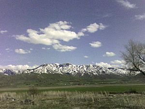
The Bear River Range forms the eastern edge of a wide, flat area called Cache Valley. This valley is home to many towns and farms. The mountains stand tall, creating a natural border.
Cool Facts About the Mountains
One interesting spot in these mountains is called Peter Sinks. It's a natural bowl-shaped area where cold air gets trapped. On February 1, 1985, Peter Sinks recorded the lowest temperature ever in Utah. It dropped to an amazing −69 °F (−56 °C)! This was also the second-lowest temperature recorded in the entire contiguous United States.
Getting Around the Mountains
There's only one main road that goes through the Bear River Range. It's called U.S. Highway 89, and it travels through a beautiful area known as Logan Canyon. This canyon is a very important route.
Inside Logan Canyon, you'll find the Logan River. This river flows through the mountains, adding to their natural beauty. The canyon is also home to the Beaver Mountain ski resort, a popular place for winter sports. If you love skiing or snowboarding, this is a great spot! You can also visit Tony Grove Lake, a lovely lake nestled high in the mountains. It's a perfect place for hiking and enjoying nature.
 | Jewel Prestage |
 | Ella Baker |
 | Fannie Lou Hamer |


