Logan River (Utah-Idaho) facts for kids
Quick facts for kids Logan River |
|
|---|---|

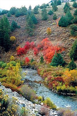
Logan River in the Wasatch-Cache National Forest
|
|
|
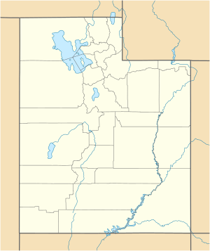
Location of the mouth of the Logan River in Utah
|
|
| Country | United States |
| State | Utah, Idaho |
| Counties | Cache County, Utah, Franklin County, Idaho |
| Physical characteristics | |
| Main source | east of Preston, Franklin County, Idaho 8,096 ft (2,468 m) 42°02′07″N 111°35′58″W / 42.03528°N 111.59944°W |
| River mouth | Little Bear River west of Logan, Cache County, Utah 4,413 ft (1,345 m) 41°44′29″N 111°57′17″W / 41.74139°N 111.95472°W |
| Length | 54 mi (87 km) |
The Logan River is a river in Utah and Idaho, United States. It is about 54 miles (87 km) long. This river is a tributary, which means it's a smaller river that flows into a larger one. The Logan River flows into the Little Bear River.
Scientists are currently studying the Logan River. They want to see if it should be named a "National Wild and Scenic River." This special title helps protect rivers that are very natural and beautiful. It keeps them safe for future generations to enjoy.
Contents
Where the Logan River Flows
The Logan River starts high up in the Bear River Range mountains. These mountains are located in Idaho. From there, the river flows south. Then it turns southwest.
Journey Through Logan Canyon
The river travels through a beautiful area called Logan Canyon. It also flows through the Wasatch-Cache National Forest. This forest is a protected area with lots of trees and wildlife.
Reaching the Valley
Eventually, the Logan River reaches the city of Logan, Utah. This city is in the Cache Valley. A few miles west of Logan, the river joins the Little Bear River. The Little Bear River then flows into the larger Bear River.
Dams on the River
There are a few dams on the Logan River. These dams are located at the start of Logan Canyon. They are called the 1st, 2nd, and 3rd dams. Dams can help control water flow and store water.
 | Anna J. Cooper |
 | Mary McLeod Bethune |
 | Lillie Mae Bradford |


