Mooresville, Missouri facts for kids
Quick facts for kids
Mooresville, Missouri
|
|
|---|---|
|
Village
|
|

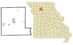
Location of Mooresville, Missouri
|
|
| Country | United States |
| State | Missouri |
| County | Livingston |
| Area | |
| • Total | 0.18 sq mi (0.46 km2) |
| • Land | 0.18 sq mi (0.46 km2) |
| • Water | 0.00 sq mi (0.00 km2) |
| Elevation | 915 ft (279 m) |
| Population
(2020)
|
|
| • Total | 98 |
| • Density | 547.49/sq mi (211.04/km2) |
| Time zone | UTC-6 (Central (CST)) |
| • Summer (DST) | UTC-5 (CDT) |
| ZIP code |
64664
|
| Area code(s) | 660 |
| FIPS code | 29-49790 |
| GNIS feature ID | 2399393 |
Mooresville is a small village located in the western part of Livingston County, Missouri, in the United States. According to the 2020 census, 98 people live there.
Contents
A Look Back in Time
Mooresville was officially planned and laid out in 1860 by a person named W. B. Moore. The village was named after him. A post office has been open in Mooresville since 1860. The village became an officially recognized town in 1874.
Where is Mooresville?
According to the United States Census Bureau, the village covers a total area of about 0.18 square miles (0.46 square kilometers). All of this area is land, with no water.
Who Lives in Mooresville?
| Historical population | |||
|---|---|---|---|
| Census | Pop. | %± | |
| 1880 | 172 | — | |
| 1910 | 205 | — | |
| 1920 | 193 | −5.9% | |
| 1930 | 137 | −29.0% | |
| 1940 | 170 | 24.1% | |
| 1950 | 134 | −21.2% | |
| 1960 | 117 | −12.7% | |
| 1970 | 131 | 12.0% | |
| 1980 | 129 | −1.5% | |
| 1990 | 100 | −22.5% | |
| 2000 | 89 | −11.0% | |
| 2010 | 91 | 2.2% | |
| 2020 | 98 | 7.7% | |
| U.S. Decennial Census | |||
Mooresville Population in 2010
Based on the census from 2010, there were 91 people living in Mooresville. These people lived in 42 different homes, and 27 of these were family homes. The village had about 505.6 people per square mile.
There were 48 housing units in total. The average number of housing units per square mile was about 266.7. All of the people living in the village were White.
Out of the 42 homes, 19% had children under 18 living there. Half of the homes (50%) were married couples living together. About 7.1% of homes had a female head of household with no husband. Another 7.1% had a male head of household with no wife. About 35.7% of homes were not families.
Around 31% of all homes had only one person living in them. About 16.6% of these single-person homes had someone aged 65 or older. On average, there were 2.17 people in each household. The average family size was 2.63 people.
The average age of people in the village was 49.9 years old. About 17.6% of residents were under 18 years old. Only 2.2% were between 18 and 24 years old. About 22% were between 25 and 44 years old. A larger group, 33%, was between 45 and 64 years old. Finally, 25.3% of residents were 65 years old or older. The village had slightly more females (51.6%) than males (48.4%).
See also
 In Spanish: Mooresville (Misuri) para niños
 | Sharif Bey |
 | Hale Woodruff |
 | Richmond Barthé |
 | Purvis Young |

