Moosup Valley State Park Trail facts for kids
Quick facts for kids Moosup Valley State Park Trail |
|
|---|---|

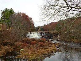
Brunswick Dam on Moosup River and North Main Street bridge
from the Moosup Valley State Park Trail |
|
| Length | 5.8 miles (9.3 km) |
| Location | Plainfield & Sterling, Connecticut |
| Established | 1987 |
| Designation | Connecticut state park |
| Trailheads | Moosup (41°42′47″N 71°52′52″W / 41.71306°N 71.88107°W) State line in Sterling (41°41′44″N 71°47′19″W / 41.69561°N 71.78855°W) |
| Use | Hiking, biking, horseback riding, cross-country skiing |
| Sights | Woodlands, Moosup River |
| Surface | Various: dirt with some grass, sand and gravel; old railroad ballast |
| Maintained by | Connecticut Department of Energy and Environmental Protection |
| Website | Moosup Valley State Park Trail |
The Moosup Valley State Park Trail is a cool path built on an old railroad track! It's located in the towns of Plainfield and Sterling in Windham County, Connecticut. This trail used to be part of the New York, New Haven and Hartford Railroad line, which operated from 1898 until 1968.
After the railroad closed in the late 1960s, the state decided to turn the old tracks into a fun, multi-use trail in 1987. Today, the Connecticut Department of Energy and Environmental Protection owns and takes care of the trail.
The trail is about 6 miles (9.7 km) long. It starts in the village of Moosup and goes all the way to the Rhode Island state line in Sterling. Once you reach Rhode Island, the trail continues as the Coventry Greenway. The Moosup Valley Trail is an important part of a bigger plan called the East Coast Greenway, which aims to create a long trail connecting cities like Hartford and Providence.
Contents
Exploring the Moosup Valley Trail
The Moosup Valley State Park Trail is a work in progress, meaning it's still being improved! You can use the entire trail, and big obstacles have been cleared away. However, some parts are still a bit rough and not fully developed.
Trail Sections and What to Expect
The trail offers different experiences depending on where you are. Here's a quick guide to what you might find:
Moosup to Barber Hill Road
This part of the trail is finished and ready for action! It has a parking area where you can start your adventure. The trail begins by crossing the Moosup River on a refurbished railroad bridge. This section is paved with a smooth, wide asphalt surface, making it great for all kinds of activities.
Barber Hill Road to Providence Road
This section is mostly undeveloped. It has been cleared and leveled, but the surface is dirt and rocky. This means it's perfect for mountain bikes and horses, but not so good for regular street bikes. You'll also find a repaired bridge over the Moosup River in Sterling here, which is ready for trail users.
Providence Road to Spring Lake Road
Good news! A brand new bridge was recently built to carry the trail over Providence Road. This new bridge replaces the old one that was removed years ago. As part of this project, about three-quarters of a mile of trail from the new bridge to Spring Lake Road was completed. This part is also paved with a wide, smooth asphalt surface, making it the first officially finished section in Sterling. The new bridge removes the last major obstacle on the trail!
Spring Lake Road to Rhode Island State Line
This section is open, but it's still undeveloped. It has a rough dirt surface, so it's best for walking or mountain biking. From here, the trail continues into Rhode Island as the Trestle Trail, which is another multi-use path.
 | Sharif Bey |
 | Hale Woodruff |
 | Richmond Barthé |
 | Purvis Young |

