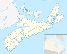
Morris Lake (Nova Scotia) facts for kids
Quick facts for kids Morris Lake |
|
|---|---|
| Location | Halifax Regional Municipality, Nova Scotia |
| Coordinates | 44°39′19″N 63°30′01″W / 44.65528°N 63.50028°W |
| Type | Eutrophic |
| Primary inflows | Russell Lake Bell Lake, Ellenvale Brook, Lamont Lake |
| Primary outflows | Cow Bay River |
| Catchment area | 17.495 km2 (6.755 sq mi) |
| Basin countries | Canada |
| Max. length | 3.55 km (2.21 mi) |
| Max. width | 0.83 km (0.52 mi) |
| Surface area | 6.4 km2 (2.5 sq mi) |
| Average depth | 3.7 m (12 ft) |
| Max. depth | 13 m (43 ft) |
| Water volume | 5,920,000 m3 (4,800 acre⋅ft) |
| Residence time | 4.1 months |
| Shore length1 | 10.1 km (6.3 mi) |
| Surface elevation | 28 m (92 ft) |
| Frozen | 2 months |
| Islands | 4 |
| Settlements | Dartmouth, Shearwater, Cole Harbour |
| 1 Shore length is not a well-defined measure. | |
Morris Lake is a long, shallow lake found in Nova Scotia, Canada. It is located within the Halifax Regional Municipality. The lake borders several communities, including Dartmouth, Shearwater, and Cole Harbour.
The lake is surrounded by different areas. To the west, you'll find Shearwater and Portland Estates. Cole Harbour is located to the east and south. On the north side, you'll see Portland Hills. Many homes and buildings are built along the northwest part of the lake's edge.
Morris Lake is important for some local activities. For example, the Imperial Oil Refinery, which is near Halifax Harbour, uses water from the lake to help cool its equipment. Also, CFB Shearwater, a Canadian Forces Base, uses a part of the lake for helicopter training. They also have a small beach there for people to enjoy.
Fun Places to Visit at Morris Lake
Morris Lake offers a few spots where you can relax and have fun outdoors. These areas are great for spending time by the water.
- Macdonalds Beach at CFB Shearwater
- Kiwanis Park Beach
Other Lakes Named Morris Lake in Nova Scotia
Did you know there's more than one Morris Lake in Nova Scotia? Another lake with the same name is located in Guysborough County. It is found at 45°4′30″N 62°18′31″W / 45.07500°N 62.30861°W.
 | Sharif Bey |
 | Hale Woodruff |
 | Richmond Barthé |
 | Purvis Young |


