Morristown, Ohio facts for kids
Quick facts for kids
Morristown, Ohio
|
|
|---|---|
|
Village
|
|

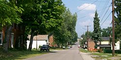
Morristown Historic District, along the National Road
|
|

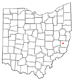
Location of Morristown, Ohio
|
|

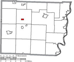
Location of Morristown in Belmont County
|
|
| Country | United States |
| State | Ohio |
| County | Belmont |
| Township | Union |
| Area | |
| • Total | 0.63 sq mi (1.63 km2) |
| • Land | 0.63 sq mi (1.63 km2) |
| • Water | 0.00 sq mi (0.01 km2) |
| Elevation | 1,247 ft (380 m) |
| Population
(2020)
|
|
| • Total | 248 |
| • Density | 394.28/sq mi (152.32/km2) |
| Time zone | UTC-5 (Eastern (EST)) |
| • Summer (DST) | UTC-4 (EDT) |
| ZIP code |
43759
|
| Area code(s) | 740 |
| FIPS code | 39-52346 |
| GNIS feature ID | 2399399 |
Morristown is a small village located in Belmont County, Ohio, in the United States. In 2020, about 248 people lived there. It is part of the larger Wheeling metropolitan area.
Contents
A Look Back: Morristown's History
Morristown was first planned and laid out in 1802. It was named after Duncan Morrison, who was one of the first people to settle in the area. People sometimes called it "Morris Town." A post office has been open in Morristown since 1807.
Several streets in downtown Morristown make up the Morristown Historic District. This special area was added to the National Register of Historic Places in 1980. This means it's an important place to protect because of its history.
Where is Morristown?
Morristown is located in Ohio. The United States Census Bureau says the village covers about 0.63 square miles (1.63 square kilometers) of land. There is no water area within the village limits.
Who Lives in Morristown?
The number of people living in Morristown changes over time. Here's a look at the population from different years:
| Historical population | |||
|---|---|---|---|
| Census | Pop. | %± | |
| 1830 | 251 | — | |
| 1850 | 456 | — | |
| 1870 | 423 | — | |
| 1880 | 434 | 2.6% | |
| 1890 | 371 | −14.5% | |
| 1900 | 350 | −5.7% | |
| 1910 | 280 | −20.0% | |
| 1920 | 315 | 12.5% | |
| 1930 | 366 | 16.2% | |
| 1940 | 410 | 12.0% | |
| 1950 | 404 | −1.5% | |
| 1960 | 396 | −2.0% | |
| 1970 | 385 | −2.8% | |
| 1980 | 463 | 20.3% | |
| 1990 | 296 | −36.1% | |
| 2000 | 299 | 1.0% | |
| 2010 | 303 | 1.3% | |
| 2020 | 248 | −18.2% | |
| U.S. Decennial Census | |||
Morristown's Population in 2010
In 2010, the census counted 303 people living in Morristown. There were 124 households, which are groups of people living together. About 78 of these were families.
Most people in the village were White (96.7%). A small number were African American (1.7%), Native American (0.3%), or from other backgrounds. About 1% of the population was Hispanic or Latino.
Households and Families
About 24.2% of households had children under 18 living with them. More than half (50.8%) were married couples. Some households had a single parent, either a mother (8.9%) or a father (3.2%). About 29% of households were individuals living alone.
The average household had 2.24 people. The average family had 2.73 people.
Age of Residents
The average age of people in Morristown in 2010 was 43.8 years old.
- 24.4% of residents were under 18 years old.
- 7.7% were between 18 and 24 years old.
- 18.8% were between 25 and 44 years old.
- 30.7% were between 45 and 64 years old.
- 18.5% were 65 years or older.
More males lived in the village than females. About 54.1% of the population was male, and 45.9% was female.
Getting Around Morristown
Interstate 70 is a major highway located about half a mile south of Morristown. The closest exit is at Mile Marker 208. Morristown's Main Street is actually the original US 40, which is a historic road.
See also
 In Spanish: Morristown (Ohio) para niños
 | Audre Lorde |
 | John Berry Meachum |
 | Ferdinand Lee Barnett |

