Daniell Peninsula facts for kids
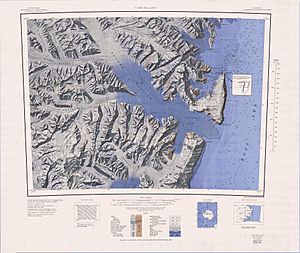
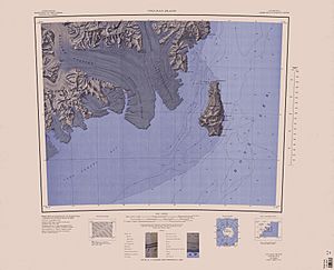
Daniell Peninsula (72°50′S 169°35′E / 72.833°S 169.583°E) is a large strip of land in Victoria Land, Antarctica, that sticks out into the sea. It is located between Cape Daniell and Cape Jones.
This peninsula is a huge dome made of basalt, a type of volcanic rock. It looks a lot like the nearby Adare Peninsula and Hallett Peninsula. It's a very high piece of land, reaching up to 2,000 meters (6,562 feet) tall!
The peninsula is mostly surrounded by ice and mountains. The Whitehall Glacier separates it from the Victory Mountains. A team of explorers from New Zealand named the peninsula in 1957–58. They named it after Cape Daniell, which is at its tip.
Volcanic Past
The Daniell Peninsula is actually made of at least four giant, wide shield volcanoes that overlap each other. These volcanoes are part of a big volcanic region in Antarctica called the McMurdo Volcanic Group.
Mount Brewster Volcano
Mount Brewster is the highest point on the peninsula, standing at 2,026 meters (6,647 feet). It's part of the central volcano. By studying the volcanic rocks, scientists found that some parts of Mount Brewster are about 12.4 million years old, while other lava flows are younger, at around 6.9 million years old.
Southern Volcano
At the southern end of the peninsula is another old volcano. It has been carved out by glaciers, creating a huge bowl-shaped valley called the Mandible Cirque. This area also includes smaller peaks like Tousled Peak and Mount Lubbock. Scientists dated rock from this area to be about 9.5 million years old.
Cape Daniell Volcano
The volcano at the northern end of the peninsula is about 1,910 meters (6,266 feet) high. Its top is a flat area that might be a small caldera, which is a large crater left behind after a volcanic eruption. The lava rocks here are between 5.6 and 5.8 million years old.
Geography and Landscape
The Daniell Peninsula runs along the coast of the Ross Sea. To its west are the tall Victory Mountains.
Many huge rivers of ice, called glaciers, flow around the peninsula.
- The Borchgrevink Glacier flows along the southwest coast.
- The Whitehall Glacier flows along the east coast and empties into the Tucker Inlet, a body of water at the north end of the peninsula.
- The Humphries Glacier connects to the Borchgrevink Glacier.
The peninsula has several important capes, which are points of land that stick out into the water. Cape Jones is at the southern tip, and Cape Daniell is at the northern tip.
Famous Places on the Peninsula
Here are some of the named places on the Daniell Peninsula. Many were named by the famous explorer Sir James Clark Ross in 1841.
Mount Prior
72°58′S 168°47′E / 72.967°S 168.783°E This mountain is 1,220 meters (4,003 feet) high and is located at the top of the Whitehall Glacier. It was named after George T. Prior, a scientist who studied rocks brought back from Antarctica by an expedition in the early 1900s.
Mount Brewster
72°57′S 169°23′E / 72.950°S 169.383°E This peak is the highest point on the peninsula, at 2,025 meters (6,644 feet). In 1841, Sir James Clark Ross named it after Sir David Brewster, a famous Scottish physicist.
Cape Jones
73°17′S 169°13′E / 73.283°S 169.217°E This cape marks the southern tip of the peninsula. Sir James Clark Ross discovered it in 1841 and named it for Captain William Jones of the Royal Navy.
Mount Lubbock
73°13′S 169°08′E / 73.217°S 169.133°E This coastal peak is 1,630 meters (5,348 feet) high and sits just north of Cape Jones. Ross named it for Sir Sir John Lubbock, who was the treasurer of the Royal Society, a famous group of scientists.
Touried Peak
73°11′S 169°01′E / 73.183°S 169.017°E This small, ice-covered peak is 1,220 meters (4,003 feet) high. It was named in 1966 because its icy summit looks very messy and "tousled," like messy hair.
Narrow Neck
73°06′S 169°03′E / 73.100°S 169.050°E This is a narrow, high strip of land that connects the area around Mount Lubbock to the main part of the peninsula. It was given its simple, descriptive name in 1966.
Mandible Cirque
73°07′S 169°15′E / 73.117°S 169.250°E This is a stunning cirque, or bowl-shaped valley, on the coast. It was named in 1966 because it looks like a mandible, or jawbone, when seen from above.
Cape Phillips
73°04′S 169°36′E / 73.067°S 169.600°E This cape is located on the east side of the peninsula. Sir James Clark Ross discovered it in 1841 and named it for Lieutenant Charles G. Phillips, who was an officer on his ship, the Terror.
Cape Daniell
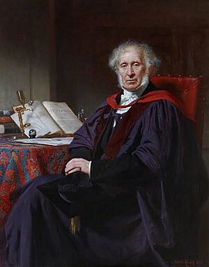
72°43′S 169°55′E / 72.717°S 169.917°E This cape is at the very northeastern tip of the peninsula. Ross discovered it on January 15, 1841, and named it for Professor John Frederic Daniell, a well-known chemist.
 | Selma Burke |
 | Pauline Powell Burns |
 | Frederick J. Brown |
 | Robert Blackburn |


