Mount Brown Conservation Park facts for kids
Quick facts for kids Mount Brown Conservation ParkSouth Australia |
|
|---|---|
|
IUCN Category VI (Managed Resource Protected Area)
|
|
| Nearest town or city | Quorn |
| Established | 4 November 1993 |
| Area | 22.64 km2 (8.7 sq mi) |
| Managing authorities | Department for Environment and Water |
| Website | Mount Brown Conservation Park |
| See also | Protected areas of South Australia |
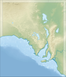
Mount Brown Conservation Park is a special protected area in South Australia. It is located in the beautiful Flinders Ranges, a mountain range known for its stunning landscapes. This park helps protect important plants and animals. It's a great place for outdoor activities like walking, and it even has a part of the famous Heysen Trail passing through it.
The park is managed by the Department for Environment and Water. You can visit for free! It is about 14 kilometers (9 miles) south of Quorn. It is also about 300 kilometers (186 miles) north of the nearest airport in Adelaide.
This conservation park is classified as an IUCN Category VI protected area. This means it is an area managed mainly for protecting ecosystems and for sustainable use of natural resources.
Contents
Park History
The Mount Brown Conservation Park was officially created in November 1993. It got its name from an older forest reserve that used to be in the same area.
Land Use Over Time
First People of the Land
Before European settlers arrived, the land where the park now stands was cared for by the Nukunu people. They were the traditional owners of this land for a very long time.
Early European Visits
The first Europeans to visit this area were a group from a ship called HMS Investigator. This group was led by a Scottish botanist named Robert Brown. They climbed Mount Brown on March 10 and 11, 1802.
Land Use Changes
From the 1870s, the land was used for forestry. This meant growing trees, especially for planting in drier parts of South Australia and other Australian states. After 1900, the tree nursery stopped operating. The land was then leased out for pastoralism, which means raising livestock like sheep or cattle. This continued until the 1990s.
Part of the land was declared a forest reserve, possibly in 1925. In 1990, the forest reserve status was removed. This happened as part of a plan by the South Australian government agency, the Department of Woods and Forests, to manage its land better.
 | Roy Wilkins |
 | John Lewis |
 | Linda Carol Brown |


