Mount Capps facts for kids
Quick facts for kids Mount Capps |
|
|---|---|
| Highest point | |
| Elevation | 10,551 ft (3,216 m) |
| Prominence | 340 ft (100 m) |
| Geography | |
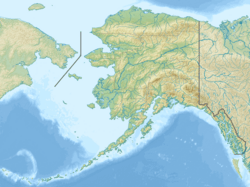
| Location | Denali Borough, Alaska, United States |
| Parent range | Alaska Range |
| Topo map | USGS Mount McKinley A-3 |
| Climbing | |
| Easiest route | From Kahiltna Pass |
Mount Capps is a tall mountain in Alaska, standing at 10,551 feet (3,216 meters) high. It is part of the Alaska Range, a large mountain chain. This mountain is located inside Denali National Park and Preserve, a huge and wild area in the United States.
About Mount Capps
Mount Capps is found southwest of Denali, which is the tallest mountain in North America. It sits on a ridge between Denali and another peak called Mount Crosson.
Where is Mount Capps?
This mountain is close to a place called Kahiltna Dome. It is also near the starting points of two large ice rivers, known as glaciers. These are the Peters Glacier and the Kahiltna Glacier. Glaciers are like very slow-moving rivers of ice.
Who was Stephen Reid Capps?
Mount Capps was named in 1952. It was named after a person named Stephen Reid Capps. He was a geologist who worked for the U.S. Geological Survey. Geologists are scientists who study the Earth, including rocks, mountains, and how the Earth changes over time.


