Mount Chapman facts for kids

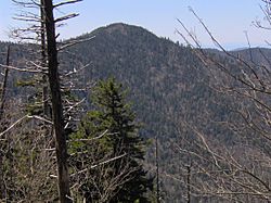
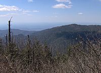
Mount Chapman is a tall mountain located in the Great Smoky Mountains in the southeastern United States. It stands 6,417 feet (1,956 meters) high, which is really impressive! Even though it's deep inside the Smokies, a famous hiking path called the Appalachian Trail goes right near its top, about 200 feet (61 meters) away. Mount Chapman is actually one of the 10 highest mountains in the entire Appalachian mountain range.
Contents
About Mount Chapman
Where is Mount Chapman?
Mount Chapman sits right on the border between Tennessee and North Carolina. Sevier County is to its north, and Swain County is to its south. Like its neighbor, Mount Guyot, Mount Chapman is a "double peak." This means it has two main high points, with the southern one being the very highest.
A gap about 1,500 feet (457 meters) deep separates Mount Chapman from Dashoga Ridge, which includes Mount Hardison and Marks Knob, about two miles (3 kilometers) to the east. The western side of Mount Chapman, called Chapman Lead, slopes down more gently. It drops about 4,000 feet (1,219 meters) over five miles (8 kilometers) to the Little Pigeon River.
What is the Forest Like?
The very top of Mount Chapman is covered in a thick forest. This forest is made up of special trees called Southern Appalachian spruce-fir trees. These trees love cool, high places and are an important part of the mountain's natural beauty.
Who Was David C. Chapman?
Mount Chapman is named after Colonel David C. Chapman (1876-1944). He was a business leader from Knoxville who worked very hard to create the national park in the Great Smokies. From 1927 to 1937, he led the Tennessee Great Smoky Mountains Park Commission. During this time, he helped raise money and buy hundreds of pieces of land. This effort made it possible to create the Great Smoky Mountains National Park that we know today.
Early Explorers
In the late 1850s, a scientist named Arnold Guyot explored Mount Chapman. He measured its height at 6,447 feet. Guyot actually called it "Mount Alexander" back then, named after a friend from Princeton University. The part of the Appalachian Trail that crosses Mount Chapman's eastern side was built much later, in 1935.
How to Visit Mount Chapman
Mount Chapman is quite far from roads and parking areas. The closest parking lot is at the Cosby Campground, about 11 miles (18 kilometers) away. It's about 14.5 miles (23 kilometers) from Newfound Gap.
To reach Mount Chapman, you can start from the Cosby Campground. From behind Campsite B51, the Snake Den Ridge Trail goes for about 5.3 miles (8.5 kilometers). This trail connects to the Appalachian Trail at a spot called Inadu Knob.
Once you are on the Appalachian Trail from Inadu Knob, Mount Chapman's main peak is about 5.2 miles (8.4 kilometers) to the south. Along the way, the trail passes by other mountains like Old Black, Mount Guyot, and Tricorner Knob. To reach the very top of Mount Chapman, you might need to do a short "bushwhack." This means walking through dense bushes and trees where there isn't a clear path.
There's a place called the Tricorner Knob Shelter, which is a simple shelter for hikers. It's located about 1.5 miles (2.4 kilometers) northeast of Mount Chapman.
 | Delilah Pierce |
 | Gordon Parks |
 | Augusta Savage |
 | Charles Ethan Porter |


