Mount Laussedat facts for kids
Quick facts for kids Mount Laussedat |
|
|---|---|

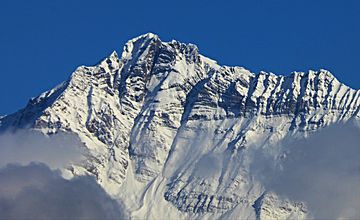
Mount Laussedat, south aspect
|
|
| Highest point | |
| Elevation | 3,052 m (10,013 ft) |
| Prominence | 986 m (3,235 ft) |
| Parent peak | Mount Mummery (3331 m) |
| Geography | |
| Location | British Columbia, Canada |
| Parent range | Southwest Central Park Ranges Canadian Rockies |
| Topo map | NTS 82N10 |
| Geology | |
| Age of rock | Cambrian |
| Type of rock | Sedimentary |
| Climbing | |
| First ascent | 1906 |
Mount Laussedat is a tall mountain in the Canadian Rockies of British Columbia, Canada. It stands 3,052 meters (about 10,013 feet) high. This makes it the highest point in the Southwest Central Park Ranges. The mountain is located about 29 kilometers (18 miles) north of Golden. It sits in the beautiful Blaeberry Valley.
First Climb
The first time anyone successfully climbed Mount Laussedat was in 1906. The climbers were C. B. Sissons, Arthur Oliver Wheeler, and M. Wheeler. This was a big achievement for them!
How the Mountain Got Its Name
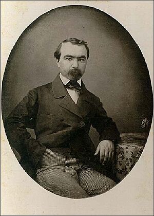
The mountain was named in 1911 by a surveyor named Arthur Oliver Wheeler. He named it after Aimé Laussedat (1819-1907). Laussedat was a French military officer. He was a pioneer in using photography to survey land. This means he used cameras to help map out areas. Wheeler and other Canadian surveyors used Laussedat's amazing techniques. The mountain's name became official on March 31, 1924. This was approved by the Geographical Names Board of Canada.
Climate Around Mount Laussedat
Mount Laussedat is in a subarctic climate zone. This means it has very cold, snowy winters. The summers are usually mild. Temperatures can drop below −20 °C (which is −4 °F). With the wind, it can feel even colder, sometimes below −30 °C (−22 °F).
Water from the mountain flows in different directions. Some of the melted snow and rain drains north into Waitabit Creek. Other water flows south into the Blaeberry River. Both of these creeks and rivers eventually flow into the larger Columbia River.


