Mount Leura facts for kids
Quick facts for kids Mount Leura |
|
|---|---|
| Highest point | |
| Prominence | 130 m (430 ft) |
| Geography | |
| Location | Camperdown |
| Geology | |
| Volcanic field | Leura Maar |
| Last eruption | Between 5000 and 20000 years ago |
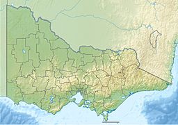
Mount Leura is an old volcano in western Victoria, Australia. It is located near the town of Camperdown. This volcano is about 194 kilometers (121 miles) southwest of Melbourne, the capital city of Victoria.
Mount Leura is a 313-meter (1,027-foot) high scoria cone. It has a dry crater that is 100 meters (328 feet) deep. Scientists believe this inactive volcano last erupted between 5,000 and 20,000 years ago. The name "Leura" means "big nose" in the local Aboriginal language.
Contents
What is the Leura Maar?
Mount Leura is part of a larger group of old volcanoes called the "Leura Maar". A maar is a wide, shallow crater formed by a volcanic explosion. The Leura Maar crater is about 2.5 kilometers (1.6 miles) long and 1.7 kilometers (1.1 miles) wide. It is surrounded by a low ring of volcanic ash called a tuff ring.
Inside this large crater, you can find Mount Leura and other smaller hills made of scoria. These smaller hills might have formed from eruptions along a crack in the Earth's surface. The sides of Mount Leura are made of layers of tuff and scoria. They also contain many large rocks and volcanic bombs (pieces of lava thrown out during an eruption).
Mount Sugarloaf: A Perfect Cone
Next to Mount Leura is a perfectly shaped hill called Mount Sugarloaf. It is a smaller, cone-shaped mound. Mount Sugarloaf formed during the final stage of the Leura volcano's activity. A small vent (opening) threw out a lot of lava fragments very quickly. This created a steep, symmetrical cone made of volcanic ash, scoria, and larger rocks.
Why is Mount Leura Important for Science?
Over the years, many quarries have operated within the Leura Maar area. These quarries are places where rock and other materials are dug out of the ground. When they dug, they uncovered layers of tuff and scoria.
These quarries are very important for scientists. They allow researchers to study the different layers of rock from the volcano. They also provide many xenoliths. Xenoliths are pieces of rock from deep inside the Earth, like the lower crust and mantle. At Mount Leura, these xenoliths are found in unusually large amounts. This makes Mount Leura a special place for geologists to learn about what's beneath the Earth's surface.
Visiting Mount Leura: What Can You See?
Mount Leura is located in a beautiful area known as the 'Lakes and Craters' region. A road was built in 1932, making it easy for cars and even buses to reach the lookout at the top of Mount Leura.
From the summit, on a clear day, you can see amazing views.
- To the north, you might spot the Grampians and Mount Buninyong.
- To the east, you can see Mount Porndon.
- To the south, you might see Lavers Hill.
- Right to the west are two deep volcanic crater lakes: Bullen-Merri and Gnotuk.
- To the east is another crater lake, Lake Purrumbete. This lake is popular for fishing, especially for Trout and Chinook Salmon.
Mount Leura Hillclimb Competition
Mount Leura has also been a host for exciting car races! It has hosted the Australian Hillclimb Championship twice, in 1985 and 1997. During these competitions, the access road to the summit is closed to the public.
The Australian Hillclimb Championship is a special event for motor sports. It has been officially approved by the Confederation of Australian Motor Sport since 1954. Before that, it was approved by the Australian Automobile Association.
 | George Robert Carruthers |
 | Patricia Bath |
 | Jan Ernst Matzeliger |
 | Alexander Miles |


