Grampians National Park facts for kids
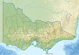
Quick facts for kids Grampians National Park / GariwerdVictoria |
|
|---|---|
|
IUCN Category II (National Park)
|
|
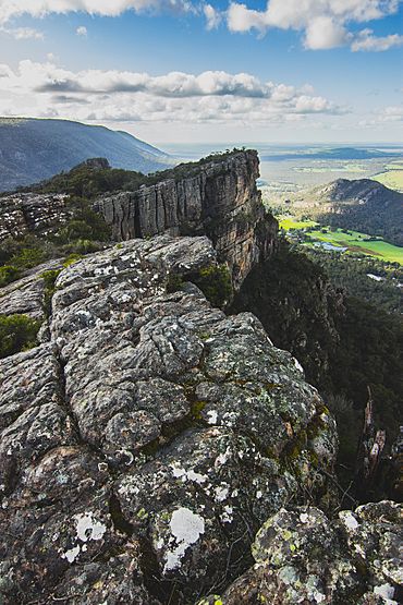
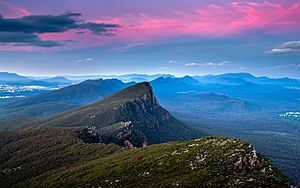
Grampians National Park / Gariwerd viewed from north of Boroka Peak
|
|
| Nearest town or city | Halls Gap |
| Established | 1 July 1984 |
| Area | 1,672.19 km2 (645.6 sq mi) |
| Managing authorities | Parks Victoria |
| Website | Grampians National Park / Gariwerd |
| See also | Protected areas of Victoria |
The Grampians National Park, often called The Grampians, is a special national park in Victoria, Australia. The local Indigenous people call the mountain ranges Gariwerd.
This huge park covers about 167,219-hectare (413,210-acre) (that's like 413,200 football fields!). It's located between the towns of Stawell and Horsham. It's about 260 kilometres (160 mi) west of Melbourne and 460 kilometres (290 mi) east of Adelaide. The Grampians became a national park on July 1, 1984. It was added to the National Heritage List in 2006. This was because of its amazing natural beauty. It also has some of the best Aboriginal rock art sites in south-eastern Australia.
The Grampians are known for their striking mountain ranges. These mountains are made of sandstone. The Gariwerd area holds about 90% of all the rock art in Victoria.
Contents
Naming the Grampians: A History
When Europeans first arrived, the Grampians had many Indigenous names. One important name was Gariwerd. This name came from the western Kulin Australian Aboriginal languages. These languages were spoken by the Mukjarawaint, Jardwadjali, and Djab Wurrung peoples. They shared a lot of words in their languages.
In 1841, the name Gariwerd was first written down. It was recorded by George Augustus Robinson from a Jardwadjali speaker. Other similar names were also noted, like Cowa and Gowah.
In 1836, an explorer named Sir Thomas Mitchell renamed Gariwerd. He called them the Grampians after the Grampian Mountains in his home country of Scotland. Mitchell first called them the Coast Mountains. Later, he settled on the name Grampians. The national park also took this name in 1984.
For a short time in 1991, the park was called Grampians (Gariwerd) National Park. But this name was changed back in 1992. Now, many places in the park use both the English and Indigenous names. This includes "Grampians National Park (Gariwerd)".
Exploring the Grampians: Geography and Geology
The Grampians ranges have a unique shape. From the west, you see gentle sandstone ridges running north to south. The eastern sides of these ridges are very steep. Some parts are even beyond vertical! A famous spot is Hollow Mountain near Dadswells Bridge.
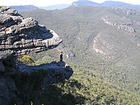
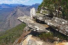
The Wonderland area near Halls Gap is very popular for day trips. It's great for walking, especially in winter and spring. Summers can be very hot and dry. The Wonderland area also has "The Grand Canyon" on the "Wonderland Loop" track. This leads to a famous viewpoint called "The Pinnacle".
Amazing Plants and Wildflowers
In spring, the Grampians are famous for their beautiful wildflowers. People call the Grampians the 'garden of Victoria'. The park is home to 975 different native plant species. This includes more than 75 types of orchids! This is about one-third of all the plants found in Victoria. Many of these plants are only found in the Grampians. One example is the Grampians pincushion lily. It's one of Australia's rarest native lilies.
Rock Formations and Highest Peak
The high peaks of the Grampians are made of sandstone. This sandstone formed from rivers about 425 to 415 million years ago. Over time, this sediment built up to a depth of 7 kilometres (4.3 mi). Later, it was pushed up and tilted to create the mountains we see today.
The highest point in the park is Mount William. It stands at 1,167 metres (3,829 ft) tall. You can find many beautiful waterfalls in the park, like Mackenzie Falls. These are easy to reach using the park's road network.
Climate of the Grampians
| Climate data for Mount William, VIC (2005–2020]); 1,150 m AMSL; 37° 18′ 00.00″ S | |||||||||||||
|---|---|---|---|---|---|---|---|---|---|---|---|---|---|
| Month | Jan | Feb | Mar | Apr | May | Jun | Jul | Aug | Sep | Oct | Nov | Dec | Year |
| Record high °C (°F) | 36.6 (97.9) |
36.6 (97.9) |
32.2 (90.0) |
26.1 (79.0) |
18.0 (64.4) |
13.4 (56.1) |
12.1 (53.8) |
16.1 (61.0) |
20.6 (69.1) |
27.0 (80.6) |
32.1 (89.8) |
34.9 (94.8) |
36.6 (97.9) |
| Mean daily maximum °C (°F) | 21.4 (70.5) |
20.3 (68.5) |
17.7 (63.9) |
12.7 (54.9) |
8.4 (47.1) |
6.3 (43.3) |
4.9 (40.8) |
5.8 (42.4) |
8.8 (47.8) |
12.9 (55.2) |
16.3 (61.3) |
18.4 (65.1) |
12.8 (55.1) |
| Mean daily minimum °C (°F) | 10.3 (50.5) |
9.7 (49.5) |
8.6 (47.5) |
6.1 (43.0) |
3.7 (38.7) |
2.0 (35.6) |
0.9 (33.6) |
1.0 (33.8) |
2.1 (35.8) |
4.0 (39.2) |
6.6 (43.9) |
7.9 (46.2) |
5.2 (41.4) |
| Record low °C (°F) | 0.9 (33.6) |
1.8 (35.2) |
−0.1 (31.8) |
−1.2 (29.8) |
−2.1 (28.2) |
−2.6 (27.3) |
−4.1 (24.6) |
−2.9 (26.8) |
−3.8 (25.2) |
−3.3 (26.1) |
−2.5 (27.5) |
−0.5 (31.1) |
−4.1 (24.6) |
| Average precipitation mm (inches) | 67.1 (2.64) |
35.0 (1.38) |
53.3 (2.10) |
74.1 (2.92) |
134.6 (5.30) |
123.2 (4.85) |
177.6 (6.99) |
155.3 (6.11) |
116.6 (4.59) |
76.1 (3.00) |
70.2 (2.76) |
66.1 (2.60) |
1,149.2 (45.24) |
| Average precipitation days (≥ 0.2 mm) | 9.2 | 11.2 | 13.6 | 17.3 | 22.4 | 24.4 | 25.9 | 23.5 | 21.0 | 15.9 | 14.6 | 12.4 | 211.4 |
Cultural Heritage and Ancient Life
Ancient Animal Tracks
In 1873, sandstone slabs from the Grampians were used to build a nearby station. On one of these slabs, 23 impressions were found. These were tracks of a four-legged animal, about 850 millimetres (33 in) long. These tracks are thought to be the oldest signs of a vertebrate (an animal with a backbone) walking on land!
Aboriginal Australian Heritage and Rock Art
To the Jardwadjali and Djab Wurrung peoples, Gariwerd was a very important place. It was central to the stories of the creator, Bunjil. It was also important for buledji Brambimbula, two brothers named Bram. They created and named many features in the landscape of western Victoria.
Grampians National Park (Gariwerd) has some of the richest Indigenous rock art sites in south-eastern Australia. It's on the National Heritage List for its natural beauty and its strong links to Aboriginal culture. The rock art in many caves shows humans, human hands, animal tracks, and birds.
Some important rock art sites include:
- Billimina (Glenisla shelter)
- Jananginj Njani (Camp of the Emu's Foot)
- Manja (Cave of Hands)
- Larngibunja (Cave of Fishes)
- Ngamadjidj (Cave of Ghosts)
- Gulgurn Manja (Flat Rock)
The Jardwadjali and Djab Wurrung peoples created this rock art. Even today, Aboriginal communities share their knowledge and traditions. However, some Indigenous knowledge has been lost since Europeans settled the area in the 1840s. For example, the meaning of the right hand prints at Gulgurn Manja is not known anymore.
Bunjil's Shelter is another very important Aboriginal cultural site. It's not inside the park, but nearby. It's the only known rock art showing Bunjil, the creator-being in Aboriginal Australian stories.
Many places in the park now have dual names. These names use both the Jardwadjali and Djab Wurrung names. Some examples are:
- Grampians / Gariwerd (mountain range)
- Mount Zero / Mura Mura (little hill)
- Halls Gap / Budja Budja
- Mount Stapylton / Gunigalg
- Mount Difficult / Gar
Fun Activities in the Grampians
Gariwerd and the Grampians National Park have been popular for visitors since the mid-1800s. More people started visiting when railways were built to nearby towns. Later, cars and new roads made it even easier to explore the mountains.
Rock Climbing Adventures
The Grampians is a very famous place for rock climbing. The first climbing routes were set up in the 1960s. Some routes, like The Wheel of Life and Groove Train, attract world-class climbers. Many climbers think the Grampians are almost perfect for climbing. This is because of easy access, good weather, and the type of rock.
In 2019, some climbing areas were closed by Parks Victoria. This was done to protect cultural sites and nature. This led to discussions between climbers and park authorities.
Bushwalking and Hiking Trails
In 2015, Parks Victoria started building the Grampians Peaks Trail. This long trail is about 160 km. It's designed for a 13-day walk and goes across the whole park. It was finished in 2020.
Tourist Towns and Cultural Centres
Halls Gap / Budja Budja is the biggest town in the area. It's located in the middle of the park. It offers places to stay for the many tourists who visit.
The Brambuk National Park and Cultural Centre is also in Halls Gap. It's owned and managed by Jardwadjali and Djab Wurrung people. These five Aboriginal communities have historical links to the Gariwerd-Grampians ranges.
Grampians Grape Escape Festival
The Grampians National Park hosts one of Australia's oldest food and wine festivals. It's called Grampians Grape Escape. It happens every year in Halls Gap on the first weekend of May. This festival started in 1992. It offers food and wine from over 100 local producers. There's also live music and fun for families.
Natural Events and Recovery
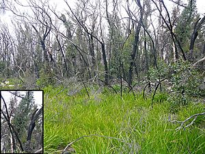
In January 2006, a large bushfire burned about half of the Grampians National Park. But soon after, nature started to recover. For example, eucalyptus trees began to regrow. Many trees showed "epicormic growth". This is when new shoots sprout along the trunk after a fire.
Five years later, in January 2011, major floods hit the park. Some parts of the Grampians National Park had to be closed for several months.
Images for kids
See also
 In Spanish: Parque nacional de los Montes Grampianos para niños
 | Ernest Everett Just |
 | Mary Jackson |
 | Emmett Chappelle |
 | Marie Maynard Daly |


