
National Heritage List (Australia) facts for kids

Satellite image of part of the Great Barrier Reef adjacent to the Queensland coastal areas of Airlie Beach and Mackay.
|
|
| Type | Heritage register of natural, historic and indigenous places that are not owned by the Commonwealth of Australia |
|---|---|
| Country | Australia |
| Years | 2003–present |
| Preceded by | Register of the National Estate |
| Compiled by | Commonwealth of Australia via the Australian Heritage Council |
| Approved by | Minister for the Environment |
The Australian National Heritage List (also called the National Heritage List or NHL) is a special list of places in Australia. These places are chosen because they are super important to Australia's history, nature, or Indigenous culture. The list was created in 2003. It includes amazing natural spots, historic buildings, and places that are very meaningful to Indigenous Australians, like sacred sites. When a place is added to this list, it gets special protection under an important law called the Environment Protection and Biodiversity Conservation Act 1999 (or EPBC Act). You can find all the places on this list, and other heritage lists, in the online Australian Heritage Database.
Contents
A Look Back: How the List Started
The National Heritage List was created in 2003. This happened when a law called the Environment Protection and Biodiversity Conservation Act 1999 was updated.
The National Heritage List, along with the Commonwealth Heritage List, took the place of an older list. This older list was called the Register of the National Estate. It was closed and archived in 2007. The National Heritage List is for places that are incredibly important to all of Australia. The Commonwealth Heritage List is for places owned or controlled by the Australian Government.
What Makes a Place Special Enough to Be Listed?
The National Heritage List includes places that have outstanding heritage value for Australia. Once a place is on the list, it is protected by the EPBC Act. To be added to the list, a place is carefully checked by the Australian Heritage Council. They look at nine different reasons why a place might be special:
- It played an important part in Australia's natural or cultural history.
- It has rare or unique features from Australia's natural or cultural past.
- It could help us learn new things about Australia's history or nature.
- It shows important features of a certain type of Australian place or environment.
- It has special beauty that a community or group really values.
- It shows amazing creative or technical skills from a certain time.
- It has a strong or special connection with a community or group for social, cultural, or spiritual reasons.
- It is linked to the life or work of an important person or group in Australia's history or nature.
- It is important as part of Indigenous traditions.
Besides these reasons, the place must be "outstanding." This means its heritage value must be truly amazing for the whole country. This is decided by comparing it to other similar places. After the Heritage Council checks everything, they send their advice to the Minister for the Environment. The Minister then makes the final decision.
How Many Places Are on the List?
As of August 10, 2020, the Australian National Heritage List had 120 special places. Here's how they are spread across Australia's states and territories:
| State/territory | Number of places |
|---|---|
| Australian Capital Territory | 5 |
| New South Wales | 36 |
| Northern Territory | 4 |
| Queensland | 13 |
| South Australia | 8 |
| Tasmania | 11 |
| Victoria | 32 |
| Western Australia | 15 |
| Other territories | 3 |
| (duplicates): | (4) |
| Total: | 120 |
Examples of Listed Places
The Australian National Heritage List includes many different types of places. Here are a few examples to give you an idea:
| # | Image | Listed place | State | Date listed | Coordinates | Notes |
|---|---|---|---|---|---|---|
| 1 |  |
Abbotsford Convent (listing) |
Victoria | 31 August 2017 | 37°48′09″S 145°00′14″E / 37.8025°S 145.003889°E | |
| 2 |  |
Adelaide Park Lands and City Layout (listing) |
South Australia | 7 November 2008 | 34°56′05″S 138°37′00″E / 34.93467°S 138.6167°E | |
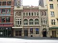
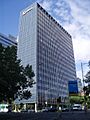
| 3 |  |
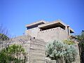
Australian Academy of Science Building (listing) |
Australian Capital Territory | 21 November 2005 | 35°17′01.2″S 149°07′21.4″E / 35.283667°S 149.122611°E | |
| 4 |  |
Australian Alps National Parks and Reserves – Alpine National Park (listing) |
Victoria | 7 November 2008 | 36°29′59″S 148°03′50″E / 36.49972°S 148.06389°E | |
| Australian Alps National Parks and Reserves – Avon Wilderness (listing) |
Victoria | 37°36′45″S 146°50′34″E / 37.61250°S 146.84278°E | ||||
 |
Australian Alps National Parks and Reserves – Baw Baw National Park (listing) |
Victoria | 37°45′50″S 146°13′23″E / 37.76389°S 146.22306°E | |||
 |
Australian Alps National Parks and Reserves – Bimberi Nature Reserve (listing) |
New South Wales | 35°34′54″S 148°45′04″E / 35.58167°S 148.75111°E | |||
 |
Australian Alps National Parks and Reserves – Brindabella National Park (listing) |
New South Wales | 35°13′54″S 148°46′44″E / 35.23167°S 148.77889°E | |||
 |
Australian Alps National Parks and Reserves – Kosciuszko National Park (listing) |
New South Wales | 36°04′20″S 148°20′55″E / 36.07222°S 148.34861°E | |||
 |
Australian Alps National Parks and Reserves – Mount Buffalo National Park (listing) |
Victoria | 36°44′18″S 146°46′30″E / 36.73833°S 146.77500°E | |||
 |
Australian Alps National Parks and Reserves – Namadgi National Park (listing) |
Australian Capital Territory | 35°40′00″S 148°57′00″E / 35.66667°S 148.95000°E | |||
| Australian Alps National Parks and Reserves – Scabby Range Nature Reserve (listing) |
New South Wales | 35°45′55″S 148°52′04″E / 35.76528°S 148.86778°E | ||||
 |
Australian Alps National Parks and Reserves – Snowy River National Park (listing) |
Victoria | 37°16′30″S 148°33′12″E / 37.27500°S 148.55333°E | |||
 |
Australian Alps National Parks and Reserves – Tidbinbilla Nature Reserve (listing) |
Australian Capital Territory | 35°27′47″S 148°54′38″E / 35.46306°S 148.91056°E | |||
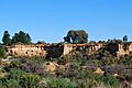
| 5 |  |
Australian Convict Sites – Brickendon Estate (listing) |
Tasmania | 23 June 2007 | 41°37′01″S 147°07′39″E / 41.61694°S 147.12750°E | World Heritage Site 2010 |
 |
Australian Convict Sites – Cascades Female Factory and Yard 4 North (listing) |
Tasmania | 1 August 2007[B] | 42°53′37″S 147°17′57″E / 42.89361°S 147.29917°E | ||
 |
Australian Convict Sites – Coal Mines Historic Site (listing) |
Tasmania | 1 August 2007 | 42°59′01″S 147°42′59″E / 42.98361°S 147.71639°E | ||
 |
Australian Convict Sites – Cockatoo Island (listing) |
New South Wales | 1 August 2007 | 33°50′49″S 151°10′16″E / 33.84684°S 151.17115°E | ||
 |
Australian Convict Sites – Darlington Probation Station (listing) |
Tasmania | 1 August 2007 | 42°34′54″S 148°04′12″E / 42.58167°S 148.07000°E | ||
 |
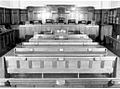
Australian Convict Sites – Fremantle Prison (listing) |
Western Australia | 1 August 2005 | 32°3′18″S 115°45′13″E / 32.05500°S 115.75361°E | ||
 |
Australian Convict Sites – Old Great North Road (listing) |
New South Wales | 1 August 2007 | 33°22′42″S 150°59′40″E / 33.37833°S 150.99444°E | ||
 |
Australian Convict Sites – Hyde Park Barracks (listing) |
New South Wales | 1 August 2007 | 33°52′10″S 151°12′45″E / 33.86944°S 151.21250°E | ||
 |
Australian Convict Sites – Kingston and Arthurs Vale Historic Area (listing) |
Norfolk Island | 1 August 2007 | 29°03′12″S 167°57′31″E / 29.05333°S 167.95861°E | ||
 |
Australian Convict Sites – Old Government House and Government Domain (listing) |
New South Wales | 1 August 2007 | 33°48′35″S 150°59′42″E / 33.80972°S 150.99500°E | ||
 |
Australian Convict Sites – Port Arthur Historic site (listing) |
Tasmania | 3 June 2005 | 43°08′52″S 147°51′05″E / 43.14778°S 147.85139°E | ||
 |
Australian Convict Sites – Woolmers Estate (listing) |
Tasmania | 23 November 2007 | 41°37′01″S 147°07′48″E / 41.61694°S 147.13000°E | ||
| 6 |  |
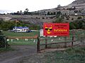
Australian Cornish Mining Sites – Burra (listing) |
South Australia | 9 May 2017 | 33°40′47″S 138°55′03″E / 33.67972°S 138.91750°E | |
.jpg) |
Australian Cornish Mining Sites – Moonta (listing) |
34°04′32″S 137°36′31″E / 34.07556°S 137.60861°E | ||||
| 7 |  |
Australian Fossil Mammal Sites (Naracoorte) (listing) |
South Australia | 21 May 2007[A] | 36°57′S 140°45′E / 36.950°S 140.750°E | Inscribed as a World Heritage Site in 1994 |
 |
Australian Fossil Mammal Sites (Riversleigh) (listing) |
Queensland | 19°04′59″S 138°43′01″E / 19.083°S 138.717°E | World Heritage Site 1994 | ||
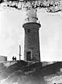
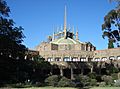
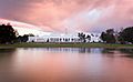
| 8 |  |
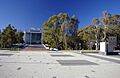
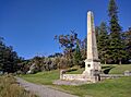
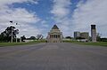
Australian War Memorial and the Memorial Parade (listing) |
Australian Capital Territory | 25 April 2006 | 35°16′49.76″S 149°08′56.56″E / 35.2804889°S 149.1490444°E | |
| 9 | .jpg) |
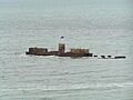
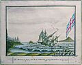
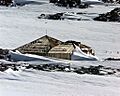
Batavia Shipwreck Site and Survivor Camps Area 1629, Houtman Abrolhos (listing) |
Western Australia | 6 April 2006 | 28°29′25″S 113°47′36″E / 28.49028°S 113.79333°E | |
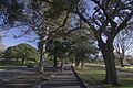
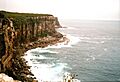
| 10 |  |
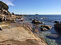
Bondi Beach (listing) |
New South Wales | 25 January 2008 | 33°53′28″S 151°16′40″E / 33.8910°S 151.2778°E | |
| 11 |  |
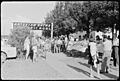
Bonegilla Migrant Camp – Block 19 (listing) |
Victoria | 7 December 2007 | 36°07′52″S 147°00′49″E / 36.1310°S 147.0136°E | |
| 12 |  |
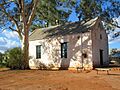
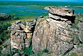
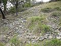
Brewarrina Aboriginal Fish Traps (Baiames Ngunnhu) (listing) |
New South Wales | 3 June 2005 | ||
| 13 |  |
City of Broken Hill (listing) |
New South Wales | 20 January 2015 | 31°57′S 141°27′E / 31.950°S 141.450°E | |
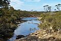
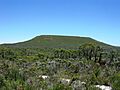
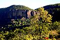
| 14 | Budj Bim National Heritage Landscape – Tyrendarra Area (listing) |
Victoria | 20 July 2004 | 38°12′00″S 141°46′00″E / 38.20000°S 141.76667°E | ||
 |
Budj Bim National Heritage Landscape – Mount Eccles Lake Condah Area (listing) |
38°04′00″S 141°55′00″E / 38.06667°S 141.91667°E |
- One of 15 World Heritage places included in the National Heritage List on 21 May 2007.
- Yard 4 North was added on 4 August 2009.
You can find the full list of all 120 places on the official Australian Heritage Database website.
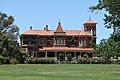
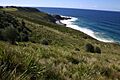
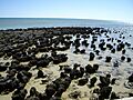
Images for kids
-

The Burke, Wills, King and Yandruwandha National Heritage Place
-
Castlemaine Diggings National Heritage Park
-
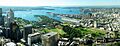
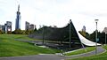
Centennial Park, Sydney
-
Coranderrk
-
Cyprus Hellene Club - Australian Hall, site of the Day of Mourning in 1938
-
Dirk Hartog Landing Site 1616 – Cape Inscription Area
-
Dinosaur Stampede National Monument
-
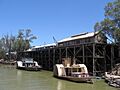
Echuca Wharf
-
Ediacara Fossil Site – Nilpena
-
Eureka Stockade Gardens
-
Fitzgerald River National Park
-
Flemington Racecourse
-
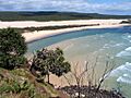
Fraser Island
-
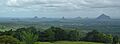
Glass House Mountains National Landscape
-
Glenrowan Heritage Precinct, site of Ned Kelly's capture
-
Goldfields Water Supply Scheme
-
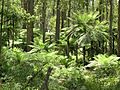
Gondwana Rainforests – Barrington Tops Area
-
Gondwana Rainforests – Focal Peak Group
-
Gondwana Rainforests – Hastings-Macleay Group
-
Gondwana Rainforests – Iluka Nature Reserve
-
Gondwana Rainforests – Main Range National Park
-
Gondwana Rainforests – New England Group
-
Gondwana Rainforests – Shield Volcano Group
-
Gondwana Rainforests – Washpool and Gibraltar Range
-
Governors' Domain and Civic Precinct
-
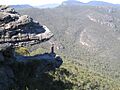
Grampians National Park (Gariwerd)
-
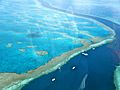
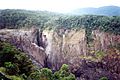
Great Barrier Reef
-
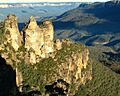
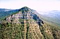
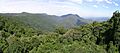
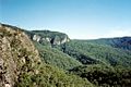
Greater Blue Mountains Area
-
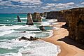
Great Ocean Road
-
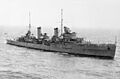
HMAS Sydney shipwreck site
-
HMVS Cerberus
-
HMS Sirius shipwreck site
-
Heard and McDonald Islands
-
Hermannsburg Historic Precinct
-
High Court of Australia (former)
-
High Court – National Gallery precinct
-
ICI Building
-
Jordan River Levee
-
Kamay Botany Bay
-
Ku-ring-gai Chase National Park
-
Kakadu National Park
-
Kurnell Peninsula Headland, James Cook's first landing site
-
Lesueur National Park
-
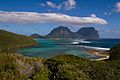
Lord Howe Island Group
-
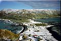
Macquarie Island
-
Mawsons Huts and Mawsons Huts Historic site
-
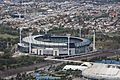
Melbourne Cricket Ground
-
Melbourne's Domain Parkland and Memorial Precinct
-
Moree Baths and Swimming Pool Complex
-
Mount William Stone Hatchet Quarry
-
Murtoa No. 1 Grain Shed
-
Newman College
-
The Ningaloo Coast
-
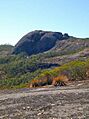
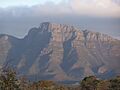
Ngarrabullgan
-
North Head, Sydney
-
Old Parliament House and Curtilage
-
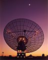
Parkes Observatory
-
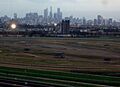
Point Cook Air Base
-
Point Nepean Defence Sites and Quarantine Station Area
-
Porongurup National Park
-
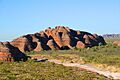
Purnululu National Park
-
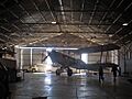
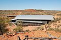
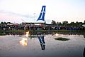
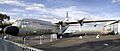
QANTAS hangar, Longreach
-
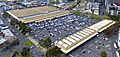
Queen Victoria Market
-
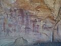
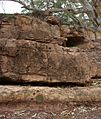
Quinkan Country
-
Recherche Bay (North East Peninsula) Area
-

Richmond Bridge
-
Rippon Lea House and Gardens
-
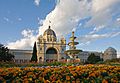
Royal Exhibition Building and Carlton Gardens
-
Royal National Park and Garawarra State Conservation Area
-
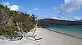
Shark Bay
-
Sidney Myer Music Bowl
-
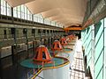
Snowy Mountains Scheme
-
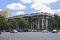
South Australia's Parliament House
-
Stirling Range National Park
-
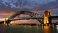
Sydney Harbour Bridge
-
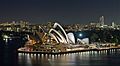
Sydney Opera House
-
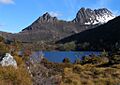
Tasmanian Wilderness
-
Tree of Knowledge, Barcaldine
-
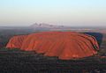
Uluru-Kata Tjuta National Park
-
Warrumbungle National Park
-
Western Tasmania Aboriginal Cultural Landscape
-
West Kimberley
-
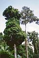
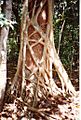
Wet Tropics of Queensland
-
Willandra Lakes Region
-
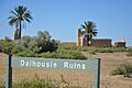
Witjira-Dalhousie Springs
-
Wurrwurrwuy stone arrangements


.jpg)


_cropped.jpg)


.jpg)


_at_the_RAAF_Museum.jpg)


