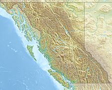
Mount McArthur (British Columbia) facts for kids
Quick facts for kids Mount McArthur |
|
|---|---|
| Highest point | |
| Elevation | 3,021 m (9,911 ft) |
| Prominence | 221 m (725 ft) |
| Listing | Mountains of British Columbia |
| Geography | |
| Location | British Columbia, Canada |
| Parent range | Park Ranges |
| Topo map | NTS 82N/10 |
| Climbing | |
| First ascent | 1891 by W.S. Drewry, Dominion Topographic Survey |
Mount McArthur is a tall mountain found in Yoho National Park, British Columbia, Canada. It stands at 3,021 meters (9,911 feet) high. This mountain is part of the Park Ranges within the larger Canadian Rockies.
It was given its name in 1886 by Otto Koltz. He named it after James J. McArthur, who was a land surveyor. McArthur played an important role in mapping the Canadian Rockies for the Canadian Pacific Railway. His work helped people understand the geography of this vast area.
Location in Yoho National Park
Mount McArthur is located within Yoho National Park. This park is a beautiful natural area in British Columbia. It is known for its stunning mountains, waterfalls, and lakes. Yoho National Park is a popular spot for hiking and exploring the outdoors.
Mountain Climate
The climate on Mount McArthur is a subarctic climate. This means the mountain has very cold and snowy winters. Summers are usually mild, not too hot.
Winter Conditions
During winter, temperatures on the mountain can drop below −20 °C (minus 4 °F). With the wind chill factor, it can feel even colder, sometimes below −30 °C (minus 22 °F). Wind chill makes the air feel colder than the actual temperature. This is because wind takes away body heat faster.


