Mount Owen (Tasmania) facts for kids
Quick facts for kids Mount Owen |
|
|---|---|

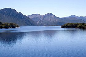
East Mount Owen wall and Lake Burbury from Bradhsaws Bridge
|
|
| Highest point | |
| Elevation | 1,146 m (3,760 ft) |
| Prominence | 774 m (2,539 ft) |
| Isolation | 8.53 km (5.30 mi) |
| Geography | |
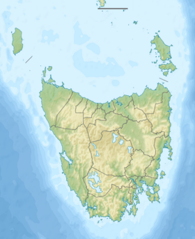
| Location | West Coast, Tasmania, Australia |
| Parent range | West Coast Range |
| Climbing | |
| Easiest route | from North West along track to TV tower |
Mount Owen is a large mountain located just east of the town of Queenstown in Western Tasmania, Australia. It is part of the West Coast Range.
This mountain stands tall at 1,146 metres (3,760 ft) above sea level. Like many mountains in the West Coast Range, it was named by a geologist named Charles Gould. He named it after a scientist called Richard Owen. Interestingly, the taller mountains in this area were often named after people who disagreed with Charles Darwin's ideas, while smaller ones were named after his supporters.
Exploring Mount Owen
In the past, Mount Owen had many more trees. However, people cut down timber from its slopes to use for local mining. In the early days, fires on the mountain sometimes destroyed houses in Queenstown. They even threatened the North Mount Lyell Railway.
By the early 1900s, much of the mountain's slopes looked quite bare. This was due to fires, smoke from smelters, and heavy rainfall.
What You Can See
The northern slopes of Mount Owen are easy to see from the Lyell Highway. This road passes through the Linda Valley. You can see how much the land has changed there.
Mount Owen has small glacial lakes on its upper eastern side. These lakes show that glaciers once covered this area, especially in the King River valley. In winter, the western slopes, which rise above Queenstown, are often covered in snow. The eastern side of the mountain hangs over the western shore of Lake Burbury.
Getting to Mount Owen
Today, you can reach Mount Owen on foot. There is a track that vehicles can use. This track leads to TV and communications towers on the mountain's north-west peak, sometimes called the 'North Spur'.
Walking to the top of Mount Owen is a moderate to hard trip. It usually takes about four hours to walk there and back. The walk begins at Karlson's Gap. This is a saddle, or low point, between Gormanston and Mount Owen. The path is made of gravel and rocks.
Other important mountains nearby include Mount Lyell to the north and Mount Huxley to the south.


