Lake Burbury facts for kids
Quick facts for kids Lake Burbury |
|
|---|---|

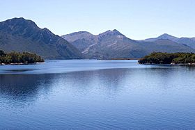
Looking north from Bradshaw Bridge
|
|
| <mapframe frameless width="300" height="300" latitude="-42.1196" longitude="145.6609" zoom="9" align="center">
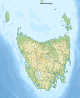
{ "type": "ExternalData", "service": "geoshape", "ids": "Q891714", "properties": { "title": "Lake Burbury", "fill": "#05286D", "stroke-width": 0 } } </mapframe>Map showing Lake Burbury in Tasmania
|
|
| Location | West Coast Range, Tasmania, Australia |
| Coordinates | 42°07′15″S 145°40′15″E / 42.12083°S 145.67083°E |
| Type | Reservoir |
| Primary inflows |
|
| Surface area | 54 km2 (21 sq mi) |
Lake Burbury is a large, man-made lake in Tasmania, Australia. It was created by building the Crotty Dam across the upper King River valley. This dam caused the valley to fill with water, forming the lake. The water from Lake Burbury is used to power the John Butters Hydroelectric Power Station. This power station helps create electricity for people in Tasmania. The lake is named after Stanley Burbury, who used to be the Governor of Tasmania.
Contents
How Lake Burbury Was Formed
Lake Burbury is a reservoir, which means it's a large, artificial lake used to store water. It was created by building the Crotty Dam. This dam blocked the flow of the upper King River. The water then filled the valley, creating the lake we see today.
The lake is mainly fed by rivers coming from the north. These include the upper King River and the Eldon River. There is also a natural lake called Lake Beatrice just north of Lake Burbury. Lake Burbury covers a large area of about 54 square kilometers.
Fishing and Features
Lake Burbury is a popular spot for fishing. However, the weather there can change very quickly and become extreme. The lake gets its water from several rivers, including the upper King, Nelson, Princess, and Eldon Rivers.
Engineers designed the Crotty Dam with special features. These features allow them to quickly lower the lake's water level. This is important if there are very heavy floods.
A bridge called the "Bradshaw" bridge crosses Lake Burbury. This bridge connects parts of the Lyell Highway. There are also two dams related to the lake. One is the Crotty Dam, located in the King River Gorge. The other is the Darwin Dam, which is near Mount Darwin.
Historical Sites Under the Water
When the Crotty Dam was built and the valley filled with water, some historical places were covered. The old towns of Darwin and Crotty are now underwater. A bridge from the North Mount Lyell Railway over the King River was also flooded. It was not taken apart before the water rose. Large parts of the Kelly Basin Road are also now beneath the lake.
People had thought about building a dam at the Crotty site a long time ago, in the early 1900s. But the project didn't happen then. It was looked at again in the 1980s. This was one of the last big dam projects built by Hydro Tasmania.
Protecting the Area Around the Lake
Lake Burbury is located to the west of the Franklin-Gordon Wild Rivers National Park. This park is a very important natural area. Around Lake Burbury, there are special protected zones. These are called buffer zones.
- The Princess River Conservation Area is on the east shore.
- The Crotty Conservation Area is also on the east shore.
- The West Coast Range Regional Reserve is on the west side.
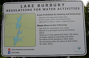
Hydro Tasmania manages the lake up to a certain elevation. This includes the water and any islands formed when the lake was created. There is even a webcam on the southeast shore of the lake. It shows the view across to where the Lyell Highway comes out of the Linda Valley. From there, the highway goes south around the eastern base of Mount Owen.
See also
 In Spanish: Lago Burbury para niños
 | Anna J. Cooper |
 | Mary McLeod Bethune |
 | Lillie Mae Bradford |


