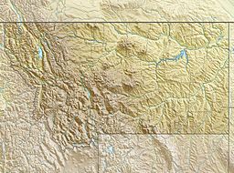
Mount Peal facts for kids
Quick facts for kids Mount Peal |
|
|---|---|
| Highest point | |
| Elevation | 12,414 ft (3,784 m) |
| Prominence | 489 ft (149 m) |
| Geography | |
| Location | Carbon County, Montana, U.S. |
| Parent range | Beartooth Mountains |
| Topo map | USGS Granite Peak |
Mount Peal is a tall and impressive mountain located in the Beartooth Mountains of Montana, a state in the western United States. Standing at 12,414 feet (3,784 m) (about 3,784 meters) high, it's one of the highest peaks in the Beartooth range. It is also the ninth tallest mountain in all of Montana!
This amazing peak is found within the Absaroka-Beartooth Wilderness area, which is part of the Custer National Forest. The closest taller mountain to Mount Peal is Tempest Mountain, which is about 1 mile (1.6 km) to the west-northwest.
Contents
Mount Peal: A Montana Giant
Mount Peal is a significant landmark in the Beartooth Mountains. Its height makes it stand out among the other peaks. Mountains like Mount Peal are formed over millions of years by powerful forces deep within the Earth.
These forces push the land upwards, creating the huge rock formations we see today. Over time, wind, water, and ice also shape the mountains, carving out valleys and sharp peaks.
Where is Mount Peal?
Mount Peal is located in Carbon County, Montana. This area is known for its rugged and beautiful natural landscapes. The Beartooth Mountains stretch across parts of Montana and Wyoming.
The mountain's exact location can be found using special coordinates. These coordinates help scientists and explorers pinpoint its spot on a map. It's a remote area, meaning it's far from big cities and towns.
Exploring the Beartooth Mountains
The Beartooth Mountains are a subrange of the Rocky Mountains. They are famous for their high plateaus, deep valleys, and many alpine lakes. These mountains are home to a variety of plants and animals.
The name "Beartooth" comes from a peak that looks like a bear's tooth. This mountain range is a popular spot for hiking, climbing, and enjoying nature. It offers stunning views and challenging trails for adventurers.
What is a Wilderness Area?
Mount Peal is located inside the Absaroka-Beartooth Wilderness. A wilderness area is a special place protected by law. It means that humans can visit, but they must leave no trace.
In wilderness areas, there are no roads, buildings, or machines. The goal is to keep the land as natural as possible. This helps protect the plants, animals, and natural beauty for future generations.
Custer National Forest
The Absaroka-Beartooth Wilderness is part of the larger Custer National Forest. A national forest is an area of land managed by the U.S. government. These forests are used for many purposes.
They provide timber, protect wildlife, offer recreational activities, and help keep our air and water clean. Custer National Forest is a vast area with diverse landscapes, from forests to high mountain peaks.
 | Sharif Bey |
 | Hale Woodruff |
 | Richmond Barthé |
 | Purvis Young |


