Mount Pisgah (Lane County, Oregon) facts for kids
Quick facts for kids Mount Pisgah |
|
|---|---|

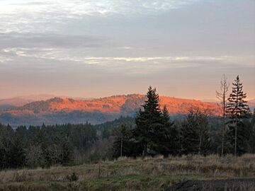
Mount Pisgah at sunset
|
|
| Highest point | |
| Elevation | 1,531 ft (467 m) |
| Geography | |
| Location | Lane County, Oregon, U.S. |
| Parent range | Cascade Range |
| Topo map | USGS Cruso |
| Geology | |
| Mountain type | Stratovolcano |
| Climbing | |
| Easiest route | Hike |
Mount Pisgah is a small mountain in Lane County, Oregon, United States. It rises about 1,060 feet (323 meters) above the land around it. The mountain's highest point is 1,531 feet (467 meters) tall.
It was named after a mountain mentioned in the Bible. Mount Pisgah sits between two parts of the Willamette River, about 2 miles (3.2 km) southeast of where they meet. The city of Springfield is just north of Mount Pisgah. The city of Eugene is about 7 miles (11 km) to the west. This area is home to the 2,363-acre Howard Buford Recreation Area. You can also find the Mount Pisgah Arboretum at its base.
Contents
Discover Mount Pisgah
Mount Pisgah is a great place to explore nature. It offers beautiful views and fun trails for everyone.
What is Mount Pisgah Made Of?
The hill is mostly made of a type of rock called basalt. Sometimes, you can find small, shiny crystals of minerals like calcite and zeolite where the rock sticks out. These are often seen near the top of the mountain.
Other interesting minerals found here include agate, jasper, and quartz. Mount Pisgah is also known for its many different plants and animals. The area has open grassy fields, meadows, and forests. Lots of colorful wildflowers bloom here in the spring.
Fun Things to Do at Mount Pisgah
The Lane County Parks Department takes care of several hiking trails on Mount Pisgah. You can reach the very top by taking a steep 1.4-mile (2.3 km) trail. This trail starts from a parking area near the bottom of the hill. Other trails wind through the nearby arboretum and up the mountain slopes.
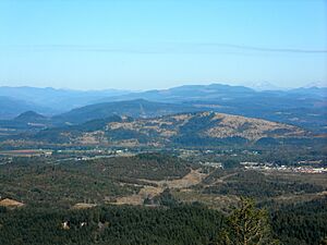
From the top, you get an amazing view of the southern Willamette Valley. There's even a special bronze sculpture there. It shows the land around you and points out many nearby mountains and rivers. This sculpture is a memorial for Jed, the son of writer Ken Kesey.
Explore the Mount Pisgah Arboretum
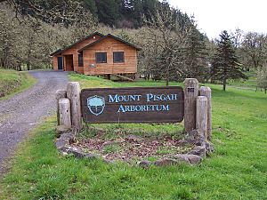
The Mount Pisgah Arboretum is a special place covering 209 acres (0.85 square kilometers) at the base of the mountain. It has 7 miles (11 km) of trails that go through natural areas along the river. You can see hundreds of different kinds of plants here.
As of May 2020, it costs $5 per car to enter. You can buy permits at a self-service station using a card.
The Willamette Confluence Preserve
In 2010, a company called Wildish Sand and Gravel sold its large property near Mount Pisgah. This 1,305-acre (5.28 square kilometers) area was bought by The Nature Conservancy (TNC). They paid $23.4 million for it. The property was then renamed the Willamette Confluence Preserve.
Since this land had been used for digging up gravel, The Nature Conservancy spent more than ten years working to bring back the native plants and animals. They also prepared the area for people to visit in a controlled way. In 2023, The Nature Conservancy gave the care of the preserve to the McKenzie River Trust. This group will continue to protect the land for the future.
 | Selma Burke |
 | Pauline Powell Burns |
 | Frederick J. Brown |
 | Robert Blackburn |


