Mount Sequoyah facts for kids
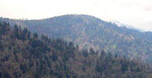
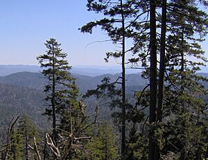
Mount Sequoyah is a tall mountain found in the Great Smoky Mountains in the southeastern United States. It stands 6,003 feet (1,830 meters) high. Even though the famous Appalachian Trail goes right over its top, Mount Sequoyah is quite far from any roads. It's about an 11.5-mile (18.5 km) hike from the closest parking spot, making it one of the most remote places in the entire Great Smoky Mountains National Park.
Where is Mount Sequoyah Located?
The border between Tennessee and North Carolina runs right across Mount Sequoyah. Sevier County is to the north, and Swain County is to the south.
This mountain actually has four smaller peaks. The one farthest to the east is the highest point. Mount Sequoyah rises about 1,500 feet (457 meters) from its southern base near Left Fork Creek. It rises even more, about 3,500 feet (1,067 meters), from its northern base along the Little Pigeon River. Some of the streams that form the Little Pigeon River start on the northern side of Mount Sequoyah.
How Mount Sequoyah Got Its Name
Mount Sequoyah is named after a very important person named Sequoyah. He was the inventor of the Cherokee alphabet. This alphabet allowed the Cherokee people to read and write their own language.
It's not likely that Sequoyah ever visited this specific mountain. However, many Cherokee villages were located at the base of the southeastern Smoky Mountains when European settlers first arrived in the early 1700s.
In the late 1850s, a man named Arnold Henry Guyot surveyed the crest of the Smokies. He crossed Mount Sequoyah during his work. Guyot called the mountain "The Three Brothers" and measured its height as 5,945 feet (1,812 meters). For a long time, not many people visited the mountain. That changed in 1935 when a part of the Appalachian Trail was built across its summit.
Exploring Mount Sequoyah's Trails
The top of Mount Sequoyah is one of the most distant spots you can reach by trail in the Great Smoky Mountains. If you start from Newfound Gap and follow the Appalachian Trail, Mount Sequoyah is 13.1 miles (21.1 km) to the east.
Another way to reach Mount Sequoyah is from the Cosby Campground. From there, you can hike 5.3 miles (8.5 km) on the Snake Den Ridge Trail until it meets the Appalachian Trail. Then, you follow the Appalachian Trail for 3.7 miles (6.0 km) to Tricorner Knob. Along this path, you will cross Old Black and Mount Guyot. From Tricorner Knob, Mount Sequoyah is 2.5 miles (4.0 km) to the southwest, just past Mount Chapman.
The Hughes Ridge Trail also ends just over two miles (3 km) southwest of Mount Sequoyah. This trail connects the Appalachian Trail and the Benton MacKaye Trail.
 | Janet Taylor Pickett |
 | Synthia Saint James |
 | Howardena Pindell |
 | Faith Ringgold |


