Mount Solitary facts for kids
Quick facts for kids Mount Solitary |
|
|---|---|

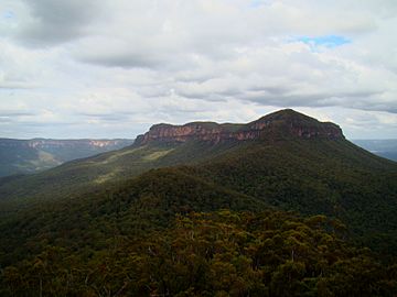
Mount Solitary as seen from the Ruined Castle
|
|
| Highest point | |
| Elevation | 950 m (3,120 ft) approx |
| Naming | |
| Native name | Error {{native name}}: an IETF language tag as parameter {{{1}}} is required (help) |
| Geography | |
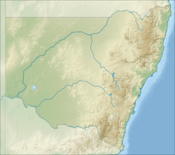
| Location | Blue Mountains region, New South Wales, Australia |
| Parent range | Blue Mountains |
Mount Solitary is a mountain in the Blue Mountains National Park, New South Wales, Australia. It is part of the Blue Mountains Range, which is a spur off the larger Great Dividing Range.
Mount Solitary is about 100 kilometers (62 miles) west of Sydney. It is also a few kilometers south of Katoomba, a main town in the Blue Mountains. Local Indigenous people called the mountain Korowal, meaning 'the strong one'. The name 'Mount Solitary' might come from it being the only mountain in the Jamison Valley.
What is Mount Solitary Like?
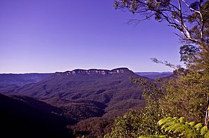
Mount Solitary sits in the middle of the Jamison Valley. This is one of the main valleys in the Blue Mountains region, just south of Katoomba. It is a long, low mountain made of sandstone. It stretches across the valley from west to east.
The top of the mountain is about 5 kilometers (3 miles) long. If you include its lower slopes, it would be about 10 kilometers (6 miles) long. At its highest point, it is about 950 meters (3,117 feet) above sea level. The mountain is mostly covered in eucalyptus forest. There is a small group of pine trees at its western end. You can also find small areas of semi-rainforest along its slopes. These areas are usually where water gathers in gullies. Sometimes, snow falls on the high parts of the mountain during winter.
Exploring Mount Solitary: Bushwalking Trails

Mount Solitary is a popular place for bushwalking. A track to the mountain starts at the Golden Stairs, near Katoomba. It heads south-east towards the lower slopes of Mount Solitary.
Along the way, you will find the Ruined Castle. This is a cool rock formation on a ridge above the track. There is also a sealed opening of an old coal mine. In this area, there is a large clearing. This clearing was once home to a mining community. Today, campers often use it.
On the western end of the mountain is Chinamans Gully. It has a large rock shelter. From the southern side of the mountain, you can see amazing views to the south. From here, the track goes down to the Kedumba River. Then it goes up to Kings Tableland, which is south of Wentworth Falls.
Safety on the Trails
Bushwalking in the Blue Mountains is an exciting adventure. However, it is very important to be prepared and stay safe. The trails can be challenging, and it is easy to get lost if you are not careful.
In December 2006, a 17-year-old bushwalker named David Iredale got lost. He was on the Katoomba to Wentworth Falls trek with his friends. A search and rescue operation was started to find him. His body was found eight days later.
In July 2009, a British tourist named Jamie Neale also got lost. He was on his way to Mount Solitary. He reached the summit but got lost on his way back down. He was lost in the bush for twelve days. Luckily, he eventually found some campers who helped him.
These stories remind us to always be careful when bushwalking. Always tell someone where you are going and when you expect to be back. Carry a map, compass, and enough water and food. It is also a good idea to have a fully charged phone for emergencies.
 | Toni Morrison |
 | Barack Obama |
 | Martin Luther King Jr. |
 | Ralph Bunche |


