Jamison Valley facts for kids
Quick facts for kids Jamison Valley |
|
|---|---|

View of the Jamison Valley from Wentworth Falls
|
|
| Length | 4 kilometres (2.5 mi) |
| Width | 10 kilometres (6.2 mi) |
| Depth | 400 metres (1,300 ft) |
| Geology | |
| Age | Triassic |
| Geography | |
| Location | Blue Mountains, New South Wales, Australia |
| Population centers | Katoomba |
| Traversed by | Sublime Point Trail |
| Rivers | Jamison Creek Kedumba River |
The Jamison Valley is a huge canyon system in the Blue Mountains of New South Wales, Australia. It's about 100 kilometres west of Sydney, which is the capital city of New South Wales. The valley is also just a few kilometres south of Katoomba, the main town in the Blue Mountains area.
Contents
History of Jamison Valley
First People of the Valley
The original owners of the land in Jamison Valley are the Aboriginal Gundungurra people. It's believed they have lived in this area for about 40,000 years. Their traditional lands stretched from the Burragorang Valley in the south, all the way north towards Goulburn.
European Exploration and Naming
The Jamison Valley was named by Governor Lachlan Macquarie in 1815. He named it after Sir John Jamison (1776-1844), who was a well-known landowner and doctor. Sir John visited the Blue Mountains with the governor.
Later, in 1836, a famous British scientist named Charles Darwin explored the area. He stayed in Wentworth Falls and walked along Jamison Creek. He was very impressed by the amazing views of the valley. Today, his walking path is called Darwin's Walk. It starts in Wilson Park, Wentworth Falls, and follows Jamison Creek to the edge of the valley.
Around 1872, coal mining began in the valley. John Britty North started it, and special equipment like the Katoomba Scenic Railway was built to help move the coal over the difficult land.
Geology and Landscape
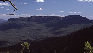
The Jamison Valley is about 4 kilometres (2.5 mi) long from north to south, stretching from Katoomba to the Mount Solitary ridge. From west to east, it is about 10 kilometres (6.2 mi) wide, reaching from Narrow Neck Plateau to Kings Tableland.
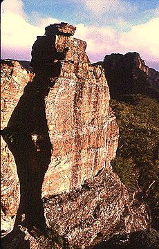
The valley is made mostly of sandstone, which forms the steep cliffs you see. Below the sandstone is a softer rock called shale. Over millions of years, water wore away the shale. When the shale collapsed, it caused the sandstone above it to fall too. This process created the unique sandstone valleys and canyons of the Blue Mountains, including Jamison Valley.
The only mountain inside the valley is Mount Solitary. It spreads across the southern part of the valley. A low ridge connects Mount Solitary to Narrow Neck Plateau. On this ridge, you'll find the Ruined Castle, which is a cool rock formation popular with hikers.
South of Mount Solitary, the valley continues through Cedar and Kedumba Valley down to Coxs River and Lake Burragorang. This lake was formed when the Warragamba Dam was built. It's an important source of drinking water for Sydney.
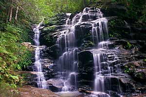
The northern edge of the valley has many deep cuts made by rivers and creeks over millions of years. Some of these waterways include Jamison Creek, Valley of the Waters Creek, and Kedumba River. There are also many beautiful waterfalls like Wentworth Falls, Empress Falls, and Katoomba Falls.
The valley is covered in thick forests. Most of it is eucalypt forest, but in the wetter, sheltered areas, you can find small patches of semi-rainforest.
Activities in Jamison Valley
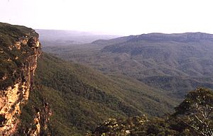
The Jamison Valley is a fantastic place for bushwalking and camping. There are many walking tracks along the northern cliffs. These include Darwin's Walk and paths in the Valley of the Waters.
You can also find tracks along the cliffs near Leura and Katoomba, as well as paths like the Federal Pass, which is at the bottom of the cliffs. A track also goes west towards the Ruined Castle and Mount Solitary. This track continues across the mountain but is best for experienced walkers. It's possible to do a long trek that takes at least three days, going up to Kings Tableland and into Wentworth Falls. Many tracks closer to the valley edge are perfect for one-day walks. Mount Solitary is mostly used for camping trips, but some people do hike there and back in one day.
Attractions in Jamison Valley
One of the main attractions is Scenic World, a tourist spot north of the valley. It has the steepest funicular railway in the world, the Katoomba Scenic Railway. This railway was first built to help with coal and oil shale mining in the valley. Scenic World also has the Scenic Skyway, a cable car that travels over part of the Jamison Valley. From the Skyway, you can see amazing views of Katoomba Falls and Orphan Rock.
The Three Sisters are famous rock formations located on the northern edge of the valley. They are one of Australia's most photographed landmarks.
The Giant Stairway is a walking track that goes down a cliff into the Jamison Valley, right near the Three Sisters. It lets you explore the valley's nature walks.
Major Lookouts for Views
- 33°45′21″S 150°17′14″E / 33.755871°S 150.287245°E - Castle Head
- 33°43′58″S 150°18′43″E / 33.732714°S 150.311948°E - Echo Point
- 33°43′59″S 150°17′56″E / 33.733048°S 150.298858°E - Eagle Hawk Lookout
- 33°43′35″S 150°19′48″E / 33.726267°S 150.329910°E - Elysian Rock Lookout
- 33°43′38″S 150°20′08″E / 33.727300°S 150.335623°E - Golf Links Lookout
- 33°43′36″S 150°19′57″E / 33.726619°S 150.332517°E - Gordon Falls Lookout
- 33°43′50″S 150°17′48″E / 33.730616°S 150.296683°E - Hilda's Lookout
- 33°43′32″S 150°22′09″E / 33.725642°S 150.369123°E - Jamison Lookout
- 33°43′19″S 150°19′11″E / 33.722005°S 150.319793°E - Kiah Lookout
- 33°43′56″S 150°18′56″E / 33.732159°S 150.315595°E - Lady Carrington Lookout
- 33°43′49″S 150°18′32″E / 33.730401°S 150.308842°E - Lady Darleys Lookout
- 33°43′55″S 150°17′45″E / 33.732068°S 150.295702°E - Landslide Lookout
- 33°44′26″S 150°22′19″E / 33.740663°S 150.371852°E - Lincoln's Rock Lookout
- 33°43′59″S 150°17′56″E / 33.733052°S 150.298872°E - Malaita Lookout
- 33°43′40″S 150°17′32″E / 33.727680°S 150.292111°E - Narrow Neck Lookout
- 33°43′43″S 150°22′25″E / 33.728561°S 150.373547°E - Rocket Point
- 33°43′58″S 150°18′47″E / 33.732766°S 150.313076°E - Spooners Lookout
- 33°44′15″S 150°20′19″E / 33.737429°S 150.338528°E - Sublime Point Lookout
- 33°43′27″S 150°19′31″E / 33.724143°S 150.325152°E - Tarpeian Rock
- 33°44′8″S 150°18′52″E / 33.73556°S 150.31444°E Three Sisters Lookout
- 33°43′34″S 150°22′19″E / 33.726006°S 150.37201°E - Wentworth Falls Lookout
- 33°43′38″S 150°22′17″E / 33.727310°S 150.37147°E - Princes Rock Lookout
Getting to Jamison Valley
The closest train stations to the valley are Katoomba railway station, Leura railway station, and Wentworth railway station. These stations are all on the Blue Mountains Line.
The Great Western Highway is the main road that runs close to the Jamison Valley.
There is also Katoomba Airfield, which is about 11.5 kilometres (7.1 mi) by road from Katoomba town. The airfield is currently closed to regular planes and helicopters. However, it can still be used by emergency services.
 | Delilah Pierce |
 | Gordon Parks |
 | Augusta Savage |
 | Charles Ethan Porter |


