Mozley Park facts for kids
Quick facts for kids |
|
|
Mozley Park Historic District
|
|
| Location | Roughly bounded by Westview Dr., West Lake Ave., Seaboard Coast Line RR tracks and M. L. King and Rockmart Dr., Atlanta, Georgia |
|---|---|
| Area | 300 acres (120 ha) |
| Architectural style | Late Victorian, Late 19th And Early 20th Century American Movements |
| NRHP reference No. | 95000909 |
| Added to NRHP | August 11, 1995 |
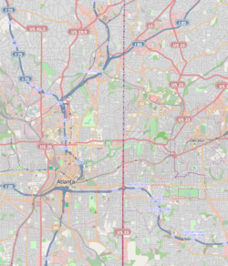
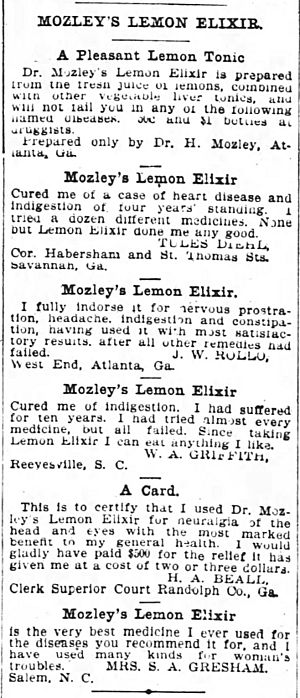
Mozley Park is a neighborhood located about three miles west of downtown Atlanta, Georgia. It's a great example of what residential areas looked like in the early 1900s. The community is named after Dr. Hiram Mozley, who owned the land. His family inherited the land after he passed away in 1902.
Contents
Building the Neighborhood
The houses in Mozley Park were built over 20 years, starting around 1920. This was when the streets were fully planned out.
Early Homes and Design
The oldest homes in the neighborhood are Folk Victorian cottages and Craftsman bungalows. These houses were built on smaller lots. They have different distances from the street and no driveways. Some small changes have been made to the houses over time. These include new awnings, siding, and additions at the back.
The neighborhood's streets are laid out in a grid pattern. This was a common way to plan many Atlanta neighborhoods. Many streets still have their original granite curbs. They also have narrow sidewalks with cool hexagonal (six-sided) pavers. Most of the lots are about 50 feet (15 m) wide.
Mozley Park Recreation Area
The Mozley Park area also includes a large recreation space. In 1922, people living in Mozley Park asked the Atlanta City Council to buy the Mozley family's land. They wanted to create a park for everyone in southwest Atlanta. Old Civil War trenches on the site were flattened to make way for the park.
The park was developed with roads, landscaped areas, and even lakes. It also had a swimming pool and a bathhouse.
Frank Lebby Stanton Elementary School
The only other non-residential building in the area is the Frank Lebby Stanton Elementary School. This school is named after Georgia's first poet laureate, Frank Lebby Stanton. It was built on a wooded hill next to Mozley Park. The school is a traditional two-story building. It's made of red brick with limestone trim and awning windows.
Changes in Mozley Park's History
Mozley Park saw many changes in its population over time. Atlanta used to have de facto residential segregation. This meant that people of different races often lived in separate areas, even if there weren't strict laws forcing it.
Neighborhood Shifts
In the 1940s, areas near Mozley Park began to change. Many white sections started to become Black neighborhoods. In 1937, a Black doctor tried to buy land in Mozley Park. However, his building plans stopped because workers faced threats. City officials even thought about building a road to separate Black areas from Mozley Park. When that didn't happen, Westview Drive became a kind of boundary. People trying to build homes for Black families near this road were sometimes threatened.
In 1948, William A. Scott, Jr., a Black man, built his home on Mozley Place. He was the son of the founder of the Atlanta Daily World newspaper. His house faced Mozley Place, which was seen as part of the white area. Because of this, some white neighbors began to sell their homes. This often led to many other white homeowners selling their properties too.
Community Efforts and Change
In 1949, some white residents formed a group to try and stop Black families from moving into their area. They wanted to buy back homes in the "white" sections. They also hoped to set a voluntary boundary line for "Negro expansion." This group was important because it was a "respectable" organization. Earlier efforts to stop Black expansion were often linked to less respectable groups.
However, there was a big shortage of housing for Black families in the city. This made it very profitable for white homeowners to sell to Black families. By 1950, Black real estate agents stopped cooperating with the efforts to keep areas segregated. In September 1951, they advertised many Mozley Park homes in the Black newspaper, the Atlanta Daily World.
The mayor of Atlanta, William B. Hartsfield, even visited the Black real estate agents. He asked them to agree that Westview Drive would be a "color line." This meant Black families would live north of it, and white families south. The agents tentatively agreed. White residents then formed a larger group and asked Mayor Hartsfield for help. In 1952, he suggested building a six-lane highway along Westview Drive. This highway would later become part of Interstate 20.
Despite these efforts, Black families continued to move into houses north of Westview Drive. By 1954, the mayor finally agreed to make the neighborhood park open for use by Black residents. Parks in Atlanta had also been segregated by race. After this, the neighborhood's racial transition was mostly complete.
Mozley Park Today
In the 1950s and 1960s, new public projects changed parts of Mozley Park. The building of Interstate 20 meant some older houses and streets were removed. However, most of the houses have not been changed much. This means the neighborhood still looks a lot like it did in the early 1900s. It remains a great example of an early 20th-century residential community.
 | Selma Burke |
 | Pauline Powell Burns |
 | Frederick J. Brown |
 | Robert Blackburn |


