Muddy, Illinois facts for kids
Quick facts for kids
Muddy
|
|
|---|---|

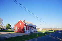
Village Hall
|
|

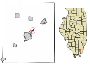
Location of Muddy in Saline County, Illinois.
|
|

Location of Illinois in the United States
|
|
| Country | United States |
| State | Illinois |
| County | Saline |
| Area | |
| • Total | 0.30 sq mi (0.79 km2) |
| • Land | 0.30 sq mi (0.78 km2) |
| • Water | 0.00 sq mi (0.00 km2) |
| Population
(2020)
|
|
| • Total | 61 |
| • Density | 201.32/sq mi (77.71/km2) |
| Time zone | UTC-6 (CST) |
| • Summer (DST) | UTC-5 (CDT) |
| ZIP Code(s) |
62965
|
| Area code(s) | 618 |
| FIPS code | 17-51271 |
| Wikimedia Commons | Muddy, Illinois |
Muddy is a small village in Saline County, Illinois, in the United States. It is part of Harrisburg Township. In 2020, about 61 people lived there.
Contents
History of Muddy
Early Settlements and Mining Origins
In the 1800s, the area where Muddy is now was home to a small place called Robinson's Ford. This settlement was even thought about for the main town of Saline County in the 1840s.
The village of Muddy started as a mining town in 1903. It was created by the Harrisburg Big Muddy Coal Company. The village was named after this company. In 1906, a bigger company called O'Gara Coal Company bought the mine.
St. Ioasaph Orthodox Church
A church named St. Ioasaph Orthodox Church was built in Muddy in 1913. It was dedicated to Ioasaph of Belgorod. The church was located on South Street.
Many immigrants from Eastern Europe went to this church. These included people from Russia, Slovakia, Poland, and Rusyns. The church building was taken down in 2019.
Geography of Muddy
Location and Nearby Features
Muddy is located at 37°45′51″N 88°30′52″W / 37.76417°N 88.51444°W. It is found along U.S. Route 45. The village is northeast of Harrisburg and southwest of Eldorado.
The Middle Fork of the Saline River flows just southwest of Muddy. The Tunnel Hill State Trail also goes through the village. This trail is a 45-mile (72 km) long path made from an old railroad line.
Area and Water
According to the 2010 census, Muddy covers a total area of about 0.301 square miles (0.78 square kilometers). Most of this area, about 0.3 square miles (0.78 square kilometers), is land. Only a very small part, about 0.001 square miles (0.003 square kilometers), is water.
Population and People
Population Changes Over Time
| Historical population | |||
|---|---|---|---|
| Census | Pop. | %± | |
| 1960 | 95 | — | |
| 1970 | 109 | 14.7% | |
| 1980 | 88 | −19.3% | |
| 1990 | 87 | −1.1% | |
| 2000 | 78 | −10.3% | |
| 2010 | 68 | −12.8% | |
| 2020 | 61 | −10.3% | |
| U.S. Decennial Census | |||
The census is a count of people living in an area. In 2000, there were 78 people living in Muddy. There were 34 households and 21 families. The population density was about 297 people per square mile (115 people per square kilometer).
There were 39 homes in the village. On average, there were about 149 homes per square mile (57 homes per square kilometer).
Diversity and Households
In 2000, most people in Muddy were White (88.46%). There were also African American (5.13%), Native American (2.56%), and other races (3.85%) living there. About 3.85% of the population was Hispanic or Latino.
Out of 34 households, 38.2% had children under 18 living with them. About 44.1% were married couples. Some households (8.8%) had a female head without a husband. About 38.2% of households were made up of individuals.
About 8.8% of households had someone 65 years or older living alone. The average household had 2.29 people. The average family had 2.95 people.
Age and Income
The population in Muddy was spread out by age. About 24.4% were under 18 years old. About 17.9% were between 18 and 24. Another 17.9% were between 25 and 44. About 26.9% were between 45 and 64. And 12.8% were 65 years or older. The average age was 34 years.
The median income for a household in the village was $24,375. For a family, the median income was $28,750. The average income per person in the village was $13,384. A small portion of the population had lower incomes.
See also
 In Spanish: Muddy (Illinois) para niños
 | William Lucy |
 | Charles Hayes |
 | Cleveland Robinson |

