
Muir Pass facts for kids
Quick facts for kids Muir Pass |
|
|---|---|
 |
|
| Elevation | 11,955 ft (3,644 m) |
| Traversed by | John Muir Trail, Pacific Crest Trail |
| Location | Fresno County, California, United States |
| Range | Sierra Nevada |
| Coordinates | 37°06′42″N 118°40′14″W / 37.11167°N 118.67056°W |
Muir Pass is a famous mountain pass in the Sierra Nevada mountains of California, United States. It's located inside Kings Canyon National Park. A mountain pass is like a low spot or a gap between mountains that makes it easier to travel from one side to the other. This pass is named after John Muir, a very important person who helped protect many natural areas in the United States.
Where is Muir Pass?
Muir Pass is a really important spot for hikers! It's almost exactly halfway along the famous John Muir Trail, which is a long hiking path through the Sierra Nevada. It's also part of the even longer Pacific Crest Trail, a super-long trail that goes from Mexico all the way to Canada.
The pass crosses something called the Goddard Divide. This is a ridge of mountains between Mount Solomons and Mount Warlow. Muir Pass is very high up, at an elevation of about 11,955 feet (or 3,644 meters) above sea level!
The Famous Muir Hut
Right at the top of Muir Pass, you'll find a special stone building called the Muir Hut. This hut was built by the Sierra Club, a group that works to protect nature. The Muir Hut is a simple shelter that hikers can use if they get caught in bad weather. It's a welcome sight for tired hikers who have climbed all the way to the top of the pass.
Hiking Challenges
Even though the path up to Muir Pass isn't super steep, hiking there can still be tricky. A lot of snow can stay on the ground well into the summer months, sometimes even covering the trail for miles! This means hikers need to be prepared for snowy conditions, even when it's warm elsewhere. It's a true adventure for those who visit!
-
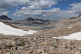
View of Lake McDermand and Wanda Lake, as you climb the pass
-
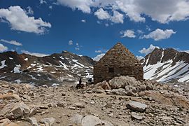
The Muir Hut, a stone shelter at the summit
-
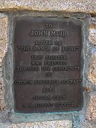
A special plaque on the Hut
-
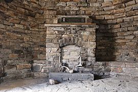
What it looks like inside the hut


