Mule Town, Ohio facts for kids
Quick facts for kids
Mule Town, Ohio
|
|
|---|---|
|
Village
|
|
| Nickname(s):
M-Town
|
|

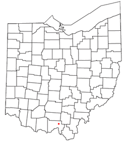
Location of Mule Town, Ohio
|
|
| Country | United States |
| State | Ohio |
| County | Scioto |
| Government | |
| • Type | Part of a civil township |
| Elevation | 653 ft (199 m) |
| Time zone | UTC-5 (Eastern (EST)) |
| • Summer (DST) | UTC-4 (EDT) |
| ZIP codes |
45653
|
| Area code(s) | 740 |
| GNIS feature ID | 1077273 |
Mule Town is a small place in Scioto County, Ohio, United States. It is also sometimes called Purdy Corners. This area is known as an unincorporated community. This means it doesn't have its own local government like a city or a village. Instead, it's part of a larger area called Madison Township.
About Mule Town
Mule Town is located in the southwestern part of Madison Township. It sits right where a few roads meet. These roads are State Route 335, Lucasville-Minford Road, and Bennett Road.
Where is Mule Town?
Mule Town is easy to find on a map of Ohio. It is just north of another small community called Minford. If you travel about 7 miles (11.5 kilometers) east, you will reach Lucasville. Lucasville is a census-designated place, which is a special type of community defined by the U.S. Census Bureau.
The largest city nearby is Portsmouth. Portsmouth is about 14 miles (23 kilometers) northeast of Mule Town. Portsmouth is important because it is the county seat of Scioto County. A county seat is usually the main town in a county where the government offices are located.
Local Geography
A small stream called Sweet Run flows past Mule Town. This stream is a tributary, which means it's a smaller stream that flows into a larger one. Sweet Run eventually joins the Rocky Fork of the Little Scioto River. Rivers and streams are important for the local environment and wildlife.
 | Misty Copeland |
 | Raven Wilkinson |
 | Debra Austin |
 | Aesha Ash |

