Municipal District of Ranchland No. 66 facts for kids
Quick facts for kids
Municipal District of Ranchland No. 66
|
|||
|---|---|---|---|

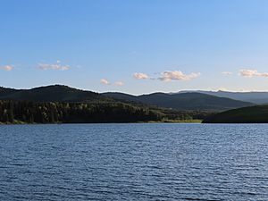
Foothills at Chain Lakes
|
|||
|
|||

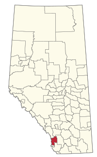
Location within Alberta
|
|||
| Country | Canada | ||
| Province | Alberta | ||
| Region | Southern Alberta | ||
| Planning region | South Saskatchewan | ||
| Established | 1995 | ||
| Incorporated | 1995 | ||
| Area
(2021)
|
|||
| • Land | 2,636.75 km2 (1,018.05 sq mi) | ||
| Population
(2021)
|
|||
| • Total | 110 | ||
| • Density | 0/km2 (0/sq mi) | ||
| Time zone | UTC−7 (MST) | ||
| • Summer (DST) | UTC−6 (MDT) | ||
The Municipal District of Ranchland No. 66 is a municipal district (MD) in southwest Alberta, Canada. Containing no urban communities of any kind, its municipal office is located in Chain Lakes Provincial Park, approximately 38 km (24 mi) southwest of the Town of Nanton. Ranchland's rugged foothill terrain is unsuited for the crop agriculture practiced elsewhere in Alberta, and ranching remains the single livelihood of its inhabitants. With a 2016 population of 92, it is the least populated municipal district in Alberta, and its population density of 29 square kilometres for every resident is almost exactly equal to that of the Northwest Territories.
Contents
History
The MD was incorporated in 1995 from the Improvement District No. 6.
Geography
Communities
There are no communities located within the MD of Ranchland No. 66.
Demographics
|
|||||||||||||||||||||||||||||||||||||||
In the 2021 Census of Population conducted by Statistics Canada, the MD of Ranchland No. 66 recorded a population of 110 living in 41 of its 55 total private dwellings, a change of 19.6% from its 2016 population of 92. With a land area of 2,636.75 km2 (1,018.05 sq mi), it had a population density of 0.0/km2 (0/sq mi) in 2021.
In the 2016 Census of Population conducted by Statistics Canada, the MD of Ranchland No. 66 recorded a population of 92 living in 38 of its 57 total private dwellings, a 16.5% change from its 2011 population of 79. With a land area of 2,638.7 km2 (1,018.8 sq mi), it had a population density of 0.0/km2 (0/sq mi) in 2016.
The MD of Ranchland No. 66's 2013 municipal census counted a population of 104.


