Murchison River (Western Australia) facts for kids
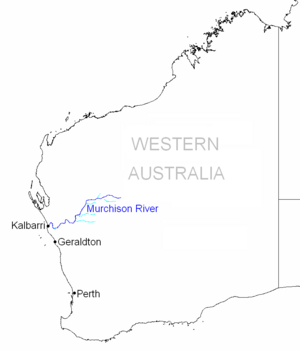
The Murchison River is a very important river in Western Australia. It's the second longest river in the state! It flows for about 820 kilometers (510 miles) from the southern part of the Robinson Ranges all the way to the Indian Ocean at Kalbarri.
The Murchison River system, which includes the Yalgar and Hope rivers, is actually the longest river system in Western Australia. It usually carries a huge amount of water, about 208 gigalitres (that's 208 billion liters!) each year. In 2006, it had a record flow of 1,806 gigalitres!
Quick facts for kids Murchison River |
|
|---|---|
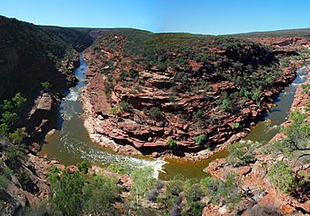
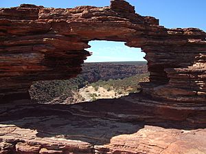
View of Murchison Gorge from the Z Bend lookout
|
|
| Country | Australia |
| Physical characteristics | |
| Main source | Robinson Ranges 521 m (1,709 ft) |
| River mouth | Indian Ocean, at Kalbarri |
| Length | 820 km (510 mi) |
| Basin features | |
| Basin size | 82,000 km2 (31,660 sq mi) |
| Tributaries |
|
Contents
River Basin and Flow
The Murchison River basin is a huge area, covering about 82,000 square kilometers (31,660 square miles). This is in the Mid West region of Western Australia. It stretches about 550 kilometers (340 miles) inland from the Indian Ocean.
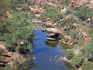
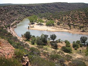
Most of the rain in the upper part of the basin comes from summer cyclones. This means that for much of the year, the Murchison River doesn't flow. Instead, you'll see a dry, sandy river bed with some permanent pools of water.
The eastern parts of the basin have many salt lakes. These lakes only flow after it rains a lot. The water from these lakes eventually joins to form the Murchison River. This happens about 90 kilometers (56 miles) north-northeast of Meekatharra. From there, the river flows west, then southwest, and finally west to the Indian Ocean.
Several towns and small communities are located within the river basin. These include Kalbarri and Meekatharra. There are also some old mining towns that are now deserted, like Galena and Nannine.
River's Journey
The Murchison River starts on the southern slopes of the Robinson Ranges. This is about 75 kilometers (47 miles) north of Meekatharra in central Western Australia.
From its source, the river flows west for about 130 kilometers (81 miles). It then meets its biggest branch, the Yalgar River. After that, it continues west for another 100 kilometers (62 miles). Then it turns southwest for 120 kilometers (75 miles), where the Roderick River joins it.
The river then flows another 70 kilometers (43 miles) southwest and meets the Sanford River, another important branch. For the next 100 kilometers (62 miles), the Murchison River makes many sharp turns. It then flows southwest, passing under the North West Coastal Highway at the Galena Bridge.
When it enters the Kalbarri National Park, the river flows northwest, then north. It carves its way through the amazing Murchison Gorge. Here, you can see famous tight bends like the Z Bend and The Loop. Finally, it turns southwest and flows into the Indian Ocean at Kalbarri. Kalbarri is the only town located right on the river.
Murchison Gorge: A Natural Wonder
The Murchison Gorge is a deep and beautiful gorge that is almost untouched by humans. It's a popular spot for tourists, with several lookouts offering amazing views.
This gorge is also very interesting for geologists, who study rocks and the Earth. It shows a cross-section of the Tumblagooda Sandstone. This rock layer is full of ancient fossils from the Ordovician period, which was millions of years ago. Scientists believe the gorge started forming about 33.9 to 38 million years ago due to movements in the Earth's crust.
River Mouth and Estuary
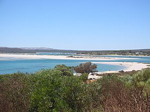
The last 18 kilometers (11 miles) of the Murchison River, from the Murchison House ford to the ocean, is an estuary. An estuary is where a river meets the sea. This part of the river has many long sandbars and shallow pools, usually less than a meter deep.
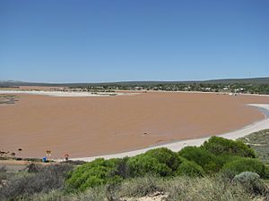
The estuary is always open to the sea. This means it's constantly affected by tides and salty seawater flowing in. When the river doesn't flow much, sand and mud from the ocean build up, making the river channel narrower. When there's a lot of rain and the river flows strongly, this sediment is pushed out to the ocean. However, strong flows also bring new sediment from upstream into the estuary.
Because of all the sediment and the constant movement from wind and river flow, the water in the estuary is often cloudy.
The very end of the estuary is a small delta. It's usually blocked by a sandbar, except for a narrow channel. Even though this channel is always open, it's often very narrow and shallow. So, it's dredged every year to allow western rock lobster fishing boats to pass through.
River History
The Murchison River was named by an explorer named George Grey. His boats were shipwrecked at the river's mouth on April 1, 1839. He named the river after his supporter, the Scottish geologist Sir Roderick Murchison. Sir Roderick had helped George Grey get official support for his expeditions in Western Australia.
Murchison House Station, one of the oldest cattle stations in Western Australia, was set up on the riverbanks in 1858.
In the 1920s and 1930s, families from the Galena mines used the estuary and river mouth as a holiday spot. During World War II, a military holiday camp was even built there.
In 1951, the town of Kalbarri was officially created at the river mouth. By the late 1990s, about 2,000 people lived there. In 1963, the Kalbarri National Park was established. This park helps protect the lower parts of the river, including the amazing gorge.
The Galena Bridge, which carries the North West Coastal Highway over the river at Galena, was opened in December 1983.
Flooding Events
The Murchison River has experienced many floods throughout history.
- In 1866, a flood caused the Geraldine Mine to be submerged. More flooding happened in 1882.
- In 1884, the southern branch of the river flooded up to 6 kilometers (3.7 miles) from its banks. The main house at Moorarie Station was washed away, along with about 3,000 sheep.
- Another big flood occurred in 1900 after heavy rains. The river was estimated to be 8 kilometers (5 miles) wide! Roads to towns like Cue and Peak Hill were under 3 meters (10 feet) of water. Roads were cut off for up to two weeks, causing food shortages in many isolated towns. Despite the damage, farmers were happy because the grass grew very quickly afterward.
- Heavy flooding also happened in March 1926. About 15 to 20 men were stuck at the Three Sister galena mine and had to be rescued by boat.
- Floods occurred again in 1939 and in February 1945. The 1945 flood was significant, sweeping away the old Galena Bridge. This left the people of Carnarvon stranded. A ferry service using a fishing boat was set up to help transport goods, especially bananas, to market.
- After Cyclone Emma in 2006, much of the river's catchment area received 100 millimeters (3.9 inches) of rain. The river swelled, becoming more than 20 kilometers (12 miles) wide in some places. Kalbarri had to be protected with sandbags to keep the floodwaters out.
See also
- Murchison River (Western Australia) for kids (in Spanish)
 | Sharif Bey |
 | Hale Woodruff |
 | Richmond Barthé |
 | Purvis Young |


