Mynydd Illtud facts for kids

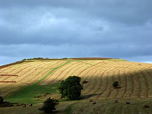
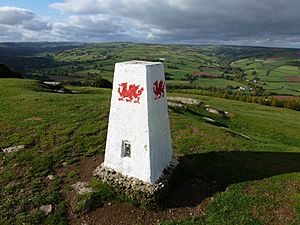
Mynydd Illtud is a large area of open land in Wales. It is found near Libanus, Powys, inside the beautiful Brecon Beacons National Park. This area is about three miles south-west of Brecon. It is a wavy, flat area, sitting between 330 and 370 meters (1,080 to 1,210 feet) above sea level. The highest spots are Allt Lom at 381 meters (1,250 feet) and Twyn y Gaer at 367 meters (1,204 feet). Twyn y Gaer has a trig point and looks over the River Usk valley. It is also the site of an Iron Age hill fort.
Contents
How the Land Was Formed

Mynydd Illtud is made from special rocks called mudstones and sandstones. These rocks are part of the St. Maughans Formation. They are also known as the Old Red Sandstone. These rocks were formed a very long time ago, during the Devonian period. This was a time when Earth looked very different. People have even dug up some of these sandstones, for example, at Allt Lom.
Long ago, during the last ice age, thick ice covered this area. You can still see signs of this ice today. There is a lot of "glacial till" spread across the land. This is a mix of dirt and rocks left behind by the melting ice. You might also spot large "erratic blocks" of sandstone. These are big rocks that the ice carried from far away.
Towards the south-west, there are two hollows called Traeth Mawr and Traeth Bach. These hollows are now filled with peat. Peat is a type of soil made from old, decayed plants. Scientists have studied this peat. It helps them learn about the weather and plants in this area over the last 10,000 years.
Visiting Mynydd Illtud
You can walk freely across all of Mynydd Illtud. It is open land for everyone to enjoy. If you like horse riding or mountain biking, you can use the smaller roads and special paths. These paths criss-cross the area.
It is important to know that you cannot drive cars or motorbikes across the common land. Only people who own land nearby or have special rights can drive vehicles here. The Brecon Beacons Mountain Centre is right next to Mynydd Illtud. It is a great place to get advice and tips for exploring the area.
Ancient History Here
The Iron Age Hill Fort
The Iron Age hillfort of Twyn y Gaer is on a grassy mound at the northern end of the common. An Iron Age hill fort was a large, protected settlement. People lived inside its walls for safety. In the middle of this hill fort, there is a trig point. A trig point is a marker used by mapmakers.
Not much of the old fort remains today. But from this spot, you get amazing views. You can see the peaks of Pen-y-Fan and Corn Du. You can also see the northern slopes of the Black Mountains and the Usk river. These great views probably explain why this naturally safe spot was chosen for a settlement long ago. A researcher named A. Hogg studied this hill fort in 1982.
Roman Roads and Rabbit Farms
You can also find traces of an old Roman road here. It is called Sarn Helen. This road runs from the south-west to the north-east across the common. The Romans built these roads to help their armies and traders move around.
Near Twyn y Gaer, there are some "pillow mounds." These mounds were built in the 1700s and 1800s. They were used to breed rabbits. People raised rabbits on a large scale for their meat and fur.
Other interesting historical sites include Llanilltyd church and its old earthworks. There is also a place called Bedd Gwyl Illtyd.
 | Bessie Coleman |
 | Spann Watson |
 | Jill E. Brown |
 | Sherman W. White |

