Nīnole, Hawaii facts for kids
Quick facts for kids
Nīnole, Kaʻū, Hawaii
|
|
|---|---|
| Country | United States |
| State | Hawaii |
| County | Hawaiʻi |
| Elevation | 85 ft (26 m) |
| Time zone | UTC-10 (Hawaii-Aleutian (HST)) |
| GNIS feature ID | 362657 |
|
Nīnole, Hāmākua, Hawaii
|
|
|---|---|
| ZIP code |
96773
|
| GNIS feature ID | 362658 |
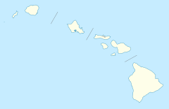
Nīnole (also spelled Hinole, Ninole, or Ninoli) is the name of two small places in Hawaii. These places are called "unincorporated communities." This means they are not officially organized towns or cities. Both Nīnole areas are on the Big Island of Hawaiʻi. They are part of Hawaiʻi County.
In the Hawaiian language, the word Nīnole means "bending." It describes something that is curved or flexible. Interestingly, one of the Nīnole communities has the highest number of people of Italian background in all of Hawaii.
Contents
Nīnole in Kaʻū District
One of the Nīnole communities is in the Kaʻū District. This area is on the southern side of the island. You can find it near Route 11, which is also called the Hawaii Belt Road. It is located just south of Punaluʻu Beach.
History of Kaʻū Nīnole
This Nīnole was once a small village. It was located by a bay called Nīnole Cove. This cove is now part of the Sea Mountain Golf Course. A very important person in Hawaiian history was born here. His name was Henry ʻŌpūkahaʻia (1792–1818). He inspired many missionaries to come to Hawaii. These missionaries brought big changes to the islands.
Sadly, much of this village was destroyed. This happened after a huge tsunami hit the area. The tsunami was caused by the 1868 Hawaii earthquake. The earthquake and tsunami caused a lot of damage.
Location Details
The elevation of this Nīnole is about 85 feet (26 meters) above sea level. Over time, this community was known by several different names. To make things clear, the United States Board on Geographic Names officially named it "Nīnole" in the year 2000.
Nīnole on the Hāmākua Coast
The second Nīnole is located on the Hāmākua Coast. This is on the northern side of the Big Island. It is along Route 19, also known as Māmalahoa Highway. This Nīnole is south of Pāpaʻaloa and north of Hakalau.
Postal Services
This Nīnole has its own post office. The ZIP code for this area is 96773. This helps mail get to the right place.
See also

- In Spanish: Nīnole para niños


